Kropa (Slovenska peč) - Sveti Primož in Felicijan (Jamnik)
Starting point: Kropa (Slovenska peč) (576 m)
Starting point Lat/Lon: 46.2869°N 14.1969°E 
Time of walking: 1 h 10 min
Difficulty: easy unmarked way
Difficulty of skiing: no data
Altitude difference: 255 m
Altitude difference (by path): 270 m
Map: Karavanke - osrednji del 1:50.000
Access to starting point:
A) We drive into Kropa, and then we continue driving towards Železniki and Dražgoše. When Kropa ends, we are still driving by the stream Kroparica, and on the right still before the left hairpin turn and Slovenska peč we notice a larger macadam area, where we park.
B) From Besnica (at Kranj) we drive towards Dražgoše, higher above the settlement Podblica we continue in the direction of Kropa. The path ahead leads us past village Jamnik, and then we start steeply descending towards Kropa. After Slovenska peč we will on the left soon notice a larger macadam area, where we park.
C) We drive to Železniki, and then we follow the signs for Dražgoše and Kropa. The path ahead leads us past village Jamnik, and then we start steeply descending towards Kropa. After Slovenska peč we will on the left soon notice a larger macadam area, where we park.
Path description:
From the starting point on the road which runs by Kroparica we ascend to Slovenska peč (Slovenska peč is the oldest preserved furnace in Slovenia, built in 14th century), opposite of which stands NOB monument, and behind the furnace, the signs for Vodice point us to the right on a worse road which quickly changes into a wide path, still before we cross Kroparica we continue sharply left on an unmarked footpath which is further ascending diagonally towards the left, and higher few times crosses an asphalt road. Higher, we stay on the road and we continue there to the right hairpin turn. From the mentioned hairpin turn, we continue straight on a cart track which then crosses slopes, and then it ascends diagonally and in few minutes brings us to a marked crossing, where we join the marked path which starts in the center of Kropa.
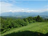
Here we continue slightly right (left downwards - Kropa, sharply right - Vodiška planina) in the direction towards Jamnik and we quickly ascend to the hunting cottage, which we bypass on the right side. From the cottage in few steps we reach an asphalt road which we follow to the left (right downwards - Kropa), and few meters behind the road sign which marks the beginning of the settlement Jamnik, we continue slightly left, on a side road in the direction of the footpath on Jamnik (right - Vodiška planina). Behind the nearby homestead, the road changes into a cart track, and by occasional nice views, which reach to Karawanks and Kamnik Savinja Alps, in few minutes of additional walking, we reach the ridge of Sveti Primož in Felicijan, on which in few minutes of easy walking, we walk to the eponymous church.
On the way: Slovenska peč v Dnu nad Kropo (583m)
Pictures:
 1
1 2
2 3
3 4
4 5
5 6
6 7
7 8
8 9
9 10
10 11
11 12
12 13
13 14
14 15
15 16
16 17
17 18
18 19
19 20
20 21
21 22
22 23
23 24
24 25
25 26
26 27
27 28
28 29
29 30
30 31
31 32
32 33
33 34
34 35
35