Lake Gradišče - Lake Gradišče (circular path around the lake)
Starting point: Lake Gradišče (355 m)
Starting point Lat/Lon: 46.1621°N 14.708°E 
Path name: circular path around the lake
Time of walking: 1 h
Difficulty: easy unmarked way
Difficulty of skiing: no data
Altitude difference: -15 m
Altitude difference (by path): 40 m
Map: Ljubljana - okolica 1:50.000
Access to starting point:
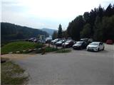
From the highway Ljubljana - Maribor, we take the Lukovica exit, then continue driving towards Moravče. After crossing Radomlje, we arrive at the beginning of the settlement Spodnje Prapreče, where at the intersection we continue left in the direction of Lake Gradišče. After a short ascent, we arrive at an intersection with the priority road, where we continue right towards Lake Gradišče (left Gradišče), then just a little further, from the priority road left towards Lake Gradišče (right Preserje pri Lukovici), in front of which we then park on the large parking lot.
Path description:
From the starting point we continue on the marked path in the direction of Limbarska gora, which continues along the northern shore of Lake Gradišče. The path, which continues on the macadam road and which is closed to public traffic, soon turns right and passes to the eastern side of the lake, where the marked path towards Limbarska gora (also the path to Sv. Mohor through the settlement Vinje pri Moravčah) turns left into the forest, while we continue further on the walking path. A shorter ascent follows, then also a descent, after the descent we again approach the lake completely. Continuing over the bridge we cross Drtiljščica, then a little further we arrive at a longer right bend, at the beginning of which an ascending macadam road branches off to the left, leading to the village Prikrnica (the junction is not marked).
Here too we continue right, a few steps further also over another small bridge, then we pass to the western side of the lake, where the path gradually retreats into dense forest. When we step out of the forest, at the intersection we continue right, then we again approach the lake, along which we continue for quite some time. In the last part we again retreat somewhat from the lake, then we ascend to the parking lot where we started the path.
The described path runs in the direction of the clock hands, but it can also be walked in the opposite direction.
The description and pictures refer to the condition in 2016 (October).
Pictures:
 1
1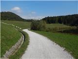 2
2 3
3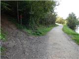 4
4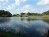 5
5 6
6 7
7 8
8 9
9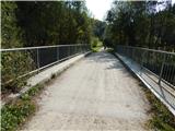 10
10 11
11 12
12 13
13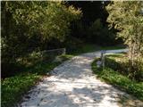 14
14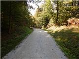 15
15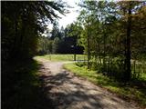 16
16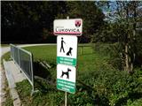 17
17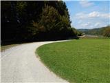 18
18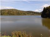 19
19 20
20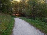 21
21 22
22 23
23 24
24 25
25 26
26 27
27