Ljubenske Rastke (Vrnivšek) - Dom na Smrekovcu
Starting point: Ljubenske Rastke (Vrnivšek) (875 m)
Starting point Lat/Lon: 46.4052°N 14.8816°E 
Time of walking: 1 h 30 min
Difficulty: easy marked way
Difficulty of skiing: no data
Altitude difference: 500 m
Altitude difference (by path): 510 m
Map: Kamniške in Savinjske Alpe 1:50.000
Access to starting point:
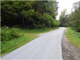
From Mozirje, Gornji Grad or Luče we drive to Ljubno ob Savinji, from there we follow the signs for Smrekovec. Through Ljubno ob Savinji we first drive on the occasionally narrower Cesta v Rastke, at crossroads between houses we follow the signs for Smrekovec. After the settlement the road widens, then to Ljubenske Rastke it mostly gently and moderately ascends, from here on it gradually becomes narrower and steeper. A little before the NOB memorial a path branches off to the right, which leads past the farm Atelšek. At the memorial the road makes two hairpin turns, then a little after MHE Naraločnik it once again turns sharply right, crosses the stream Krumpah, and then on the left we already notice the hiking signs for Dom na Smrekovcu. We park at a suitable place by the road.
Path description:
At the starting point signs for Smrekovec direct us left onto a cart track that begins to ascend through the forest. We ascend along the cart track that runs along the slopes above the left bank of the Krumpah stream, the latter overgrown with grass that they occasionally mow in a narrower strip, as otherwise the grass grows quite high. While walking along the cart track, on the right we notice pipes through which water flows for the nearby small hydropower plant, a little higher we also arrive at the water intake. At the intake the marked path also reaches the stream bed, along which it then continues. The quite slippery path runs right along the stream, a little further it crosses it and temporarily steeply ascends to the right of the stream. The steepness quickly eases, as we reach a forest road, which we follow to the left, walking along it to its end, or to the place where it turns into an ascending cart track. The cart track ascends again along the stream, then, when we approach the nearby waterfall, we cross the stream (the ascent from the bed is not entirely easy, as we must climb out of it with the help of our hands) and on the other side continue along the marked forest path. There follows a somewhat longer traverse ascent, where we cross a few torrents, and occasionally the path also leads us under cliffs. Higher up the path turns sharply right, where we first ascend over a steep slope, then the slope flattens, the cart track widens but becomes more overgrown. This section too they occasionally mow in a narrower strip to make passage along the overgrown cart track easier, only on the section through younger spruces it is not mowed, but this section is not long.
A little further we cross a macadam road that crosses most of the southern part of the Smrekovec range, and we continue along the cart track in the direction of Smrekovec.
Before the nearby wooden hut we continue left, behind it twice right, again in the direction of Smrekovec. A little further we cross another streamlet, then for a few minutes we moderately ascend. When we reach the macadam road we follow it to the nearby Dom na Smrekovcu.
Description and pictures refer to the condition in 2016 (September).
Pictures:
 1
1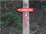 2
2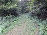 3
3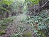 4
4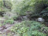 5
5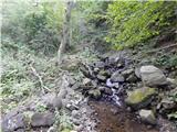 6
6 7
7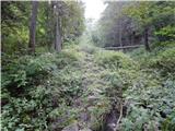 8
8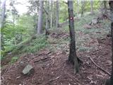 9
9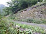 10
10 11
11 12
12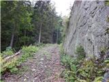 13
13 14
14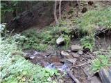 15
15 16
16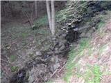 17
17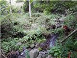 18
18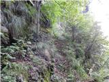 19
19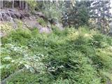 20
20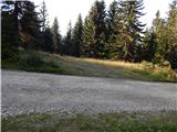 21
21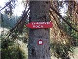 22
22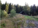 23
23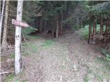 24
24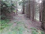 25
25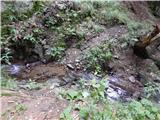 26
26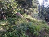 27
27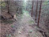 28
28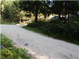 29
29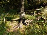 30
30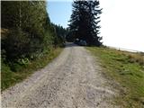 31
31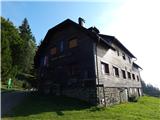 32
32