Starting point: Makole (255 m)
Starting point Lat/Lon: 46.31815°N 15.66701°E 
Time of walking: 2 h 55 min
Difficulty: easy marked way
Difficulty of skiing: no data
Altitude difference: 403 m
Altitude difference (by path): 505 m
Map:
Access to starting point:
A) We drive to Poljčane, and then we follow the signs for Majšperk and Makole. In the settlement Stranske Makole or a little after the settlement Stranske Makole we turn right towards Makole, where in the center of the settlement, we park on a marked parking lot at the cemetery.
B) We drive to Slovenska Bistrica, and then we head on the road in the direction towards Makole. We further follow the signs for Makole, and we park on a marked parking lot at the cemetery in the center of the settlement.
C) From Ptuj we follow the signs for Majšperk, and when we get to Majšperk we follow the signs for Makole. When we get to Makole we park on a marked parking lot at the cemetery.
Path description:
From the parking lot, we walk to the main road and continue right to the nearby roundabout, from which we head on the road by which there are signs for Jelovec pri Makolah and sv. Urban.
We continue on a somewhat narrower road which leads us across Jelovški potok. Makole ends a little further ahead, and from the intersection with the dead-end street we continue left, where the first blazes appear. We continue on the asphalt road which a little ahead ascends through the forest and then leads past a few houses. Further, a nice view opens up from the road, and at a few intersections we follow the signs and blazes. Higher up the road leads us past the chapel of sv. Urban, and at a few intersections we still follow the blazes. After a while we go left from the asphalt road onto a macadam road which temporarily descends slightly, and from it we go right onto a cart track which ascends along the edge of the forest. The path ahead leads us through the forest for a few minutes, and when we leave the forest we go right so that we bypass the nearby homestead on the right side, and when we reach the asphalt road we go left. Again some descent follows, at the farm Domišak the road returns into the forest and begins to ascend. In the forest we go right from the road onto a cart track along which we ascend diagonally. When we leave the cart track, from which a nice view of Boč opens up temporarily, we step onto the road which we follow to the right (left Plešivec). We do not walk along the road for long, as the blazes direct us slightly left onto a cart track which ascends diagonally to the right, and higher at the junctions we follow it in the direction of the blazes. Near the summit Kisovec the path begins to descend and takes us to a poorer road, along which we easily descend to Formila.
When we reach Formila we continue left (sharply right Studenice and Boč by road) and continue for a short time along the edge of the forest, and when the road enters the forest it takes us to a marked intersection.
At the intersection the path from Plešivec joins from the left, and we continue right in the direction of Boč. Also at the next intersection, where another path from Plešivec or Donačka gora joins, we continue right, and we also go right at the following intersection. From the last intersection we walk along the road only briefly, then we go left onto a marked path which ascends on a cart track to the place where there once stood a forestry hut, and now a new hut is being built (as of May 2022).
Here we step back onto the road which we follow left (across the road an unmarked path leads to Boč, or we can also join the road leading towards Boč). Further we walk along the road which crosses the slopes of Boč to the left, along which we first still gently ascend, and later also descend slightly.
Some ten steps before reaching the asphalt road, the shady path to Boč branches off to the right, and we continue to the road where we continue right. When the road turns left, we continue slightly right and continue along the cart track which enters the forest, at the junction we go left downhill (right Boč over Balunjača).
Only a short descent follows and we arrive at Dom na Boču.
Makole - Formila na Boču 2:00, Formila na Boču - Dom na Boču 0:55.
Description and pictures refer to the state of May 2022.
Pictures:
 1
1 2
2 3
3 4
4 5
5 6
6 7
7 8
8 9
9 10
10 11
11 12
12 13
13 14
14 15
15 16
16 17
17 18
18 19
19 20
20 21
21 22
22 23
23 24
24 25
25 26
26 27
27 28
28 29
29 30
30 31
31 32
32 33
33 34
34 35
35 36
36 37
37 38
38 39
39 40
40 41
41 42
42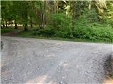 43
43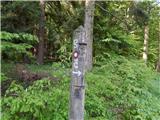 44
44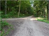 45
45 46
46 47
47 48
48 49
49 50
50 51
51 52
52 53
53 54
54 55
55 56
56 57
57 58
58 59
59 60
60 61
61 62
62 63
63