Miklavž pri Ormožu - Jeruzalem
Starting point: Miklavž pri Ormožu (232 m)
| Latitude/Longitude: | 46,46340°N 16,21170°E |
| |
Walking time: 45 min
Difficulty: easy marked way
Elevation gain: 106 m
Elevation difference along the route: 106 m
Map:
Recommended equipment (summer):
Recommended equipment (winter):
Views: 11.958
 | 1 person like this post |
Access to starting point:
A) From Ormož we drive towards Ljutomer. Soon after Ormož, we will get to a crossroads, where we continue right in the direction of Miklavž pri Ormožu. A little after Miklavž pri Ormožu, in a gentle right turn, we will notice a sign for Žuga on the road, which directs us left onto a narrower local road, along which we then park. We can also park elsewhere in the settlement of Miklavž pri Ormožu, e.g., by the cemetery, which extends the path by a few minutes.
B) From Ljutomer we drive towards Lendava. Soon after Stročja vas a road branches off to the right, which leads towards Miklavž pri Ormožu. We direct ourselves onto the mentioned road, which we then follow to a gentle left turn, in the middle of which a road branches off to the right towards the hamlet Žuga (the road towards the hamlet Žuga branches off to the right still before we enter the village Miklavž pri Ormožu). Further, follow the above description.
Route description:
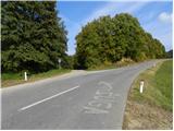
From the starting point, we continue on the road along which we have parked, which quickly brings us out of the forest onto grassy slopes. Initially a completely gentle road soon brings us to a hamlet with a few houses, then past a larger chapel, which we notice somewhat to the right from the path, brings us to a smaller crossroads, where we continue straight on a macadam road (on the right road we can get to the previously mentioned chapel). The road ahead gradually starts to ascend gently, then at one of the individual houses it turns right and for a few steps even slightly descends. A short crossing to the right follows, then the increasingly poor road turns left, where it starts to ascend moderately. The road, which further ascends moderately, brings us higher to extensive vineyards, along the edge of which we then ascend in a few minutes to an asphalt road, which we follow to the right. After a short walk on the mentioned road, we soon reach the summit, on which stands the Church of Our Lady of Sorrows.

Photos:
 1
1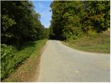 2
2 3
3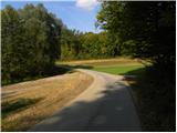 4
4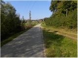 5
5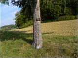 6
6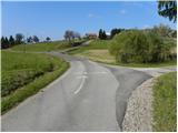 7
7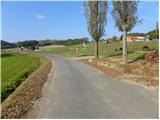 8
8 9
9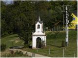 10
10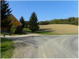 11
11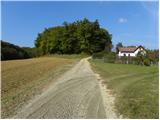 12
12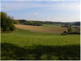 13
13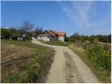 14
14 15
15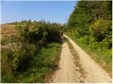 16
16 17
17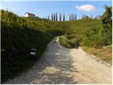 18
18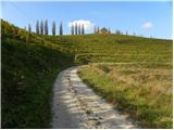 19
19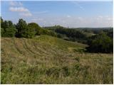 20
20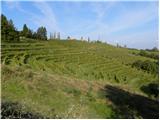 21
21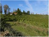 22
22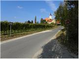 23
23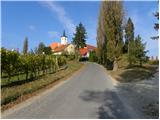 24
24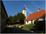 25
25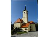 26
26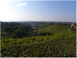 27
27
Discussion about the trip Miklavž pri Ormožu - Jeruzalem
|
| vitica10. 11. 2009 |
Prlekija, you are so beautiful!
I'm not sure if the stamp box and stamp are still there, but everything is definitely available at the TIC office at the top!
|
|
|
|
| andrejjerina10. 11. 2009 |
It's true, you get everything at the TIC office. LP Andrej
|
|
|
|
| Janiel7427. 02. 2012 |
Since no path described for Zavrh in Slovenske gorice, asking here if anyone recently used the stamp that's supposed to be there? (type Zavrh v Slovenskih goricah). So I don't drive that far in vain. Thanks
|
|
|
|
| Janiel7427. 02. 2012 |
This is the text:
Stamp of the extended Slovenian hiking trail, located approx. 50 m lower towards Lenart v Slovenskih goricah (opposite house no. 96 we notice wooden cabin, behind it private house, on whose yard is the stamping box with stamp).
|
|
|
|
| marinka674. 01. 2015 |
I spent my whole youth in this area, but now I hear about the hamlet Žuga for the first time. When I was little, we called this Slančaves. I'll ask relatives, I still have some nearby.
|
|
|
|
| sh4. 01. 2015 |
Marinka, you're right.
Someone mixed up the road sign with the place name, as it's still Slenčaves there. There's no hamlet Žuga, they just marked the birth of some child on the road and I think that sign on the road is no longer there either, at least last week it wasn't noticeable. The description needs to be corrected or changed.
Now the turn-off is also marked with a hiking sign attached to the traffic sign.
|
|
|
To post a comment you must log in:
If you do not yet have a username, you must first
register.