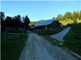
Mountain hut on farm Kumer - Govševa planina
Starting point: Mountain hut on farm Kumer (1220 m)
Starting point Lat/Lon: 46.4874°N 14.7262°E 
Time of walking: 1 h 45 min
Difficulty: easy marked way
Difficulty of skiing: no data
Altitude difference: 80 m
Altitude difference (by path): 210 m
Map: Kamniške in Savinjske Alpe 1:50.000
Access to starting point:
A) First, we drive to Luče (to here from Kamnik over the Volovjek pass (Kranjski Rak) or from the Styrian motorway past Mozirje and through Ljubno ob Savinji), then we continue driving in the direction of Logarska dolina. When we arrive in Solčava, we leave the main road and continue driving right towards Črna na Koroškem. Further, we drive along an ascending road, which we follow at the crossroads in the direction of Črna na Koroškem and Spodnje Sleme pass. From the pass onwards the road starts descending, and we follow it to the place where we join the road Črna na Koroškem - Koprivna. Here we continue left, then at the next crossroad approximately 1 km ahead right towards the mountain hut at the Kumer farm. Further, we ascend along the Koprivna stream, and we follow the road to the crossroad where the road branches off sharply to the left towards the earlier mentioned mountain hut. Here we continue left and drive to the mentioned mountain hut.
B) From Koroška we first drive to Črna na Koroškem, then we continue driving towards Podpeca and Koprivna. At the crossroad where the road towards Podpeca branches off to the right, we continue slightly left, and likewise at the next crossroad where the road into the Topla valley branches off to the right. Further we drive along the Meža river for some time, then we first arrive at the crossroad where the road towards Spodnje Sleme pass branches off to the left and further towards Logarska dolina. Here we continue straight, then at the next crossroad approximately 1 km ahead right towards the mountain hut at the Kumer farm. Further, we ascend along the Koprivna stream, and we follow the road to the crossroad where the road branches off sharply to the left towards the earlier mentioned mountain hut. Here we continue left and drive to the mentioned mountain hut.
C) First, we drive to Šoštanj, then we continue driving along a winding road towards Črna na Koroškem. In Črna na Koroškem we continue left in the direction of Podpeca and Koprivna. At the crossroad where the road towards Podpeca branches off to the right, we continue slightly left, and likewise at the next crossroad where the road into the Topla valley branches off to the right. Further we drive along the Meža river for some time, then we first arrive at the crossroad where the road towards Spodnje Sleme pass branches off to the left and further towards Logarska dolina. Here we continue straight, then at the next crossroad approximately 1 km ahead right towards the mountain hut at the Kumer farm. Further, we ascend along the Koprivna stream, and we follow the road to the crossroad where the road branches off sharply to the left towards the earlier mentioned mountain hut. Here we continue left and drive to the mentioned mountain hut.
Path description:
From the mountain hut we continue in the direction of Olševa, the path still leading along the road. Behind the hut we first bypass a chapel, a little further a cross, later also a smaller hunting observation post. When the road, continuing without major changes in altitude, enters the forest and splits into two parts, we continue on the upper right road in the direction of Olševa (slightly left church of St. Anne with black Mary 2 minutes). Further we ascend slightly to moderately, then, after a somewhat more pronounced right turn, the road levels out and brings us out of the forest onto the Rep or Repija pasture.
Behind the pasture the road descends slightly, then splits after a left turn. We continue on the slightly right road, which further ascends transversely, then quickly ends and turns into a mountain path. We continue the path through the forest, walking transversely to the left without major changes in altitude. Crossing two anthills is somewhat awkward, as the pine needles on the anthills are slippery, otherwise the crossing is undemanding. When the slope flattens we quickly arrive at a pasture fence, where along the path we notice a warning that a fierce bull is on the pasture. We cross the pasture fence and step out of the forest, where a nice view opens towards Olševa, and the trail on this section becomes somewhat harder to follow. While crossing the pasture we keep somewhat more to the right, then arrive at a strip of forest where we descend to the livestock trough. When we step out of the forest above the trough we arrive at the central part of the pasture, somewhat to the left there is a newer sign.
Kumer - Repija 45 minutes, Repija - Govševa planina 1:00.
Description and pictures refer to the condition in 2016 (August).
Pictures:
 1
1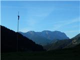 2
2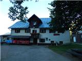 3
3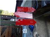 4
4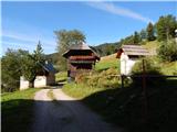 5
5 6
6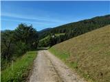 7
7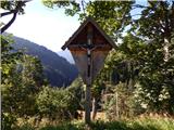 8
8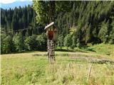 9
9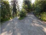 10
10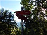 11
11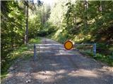 12
12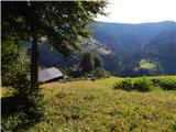 13
13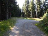 14
14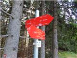 15
15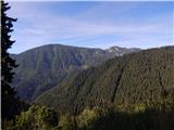 16
16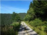 17
17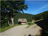 18
18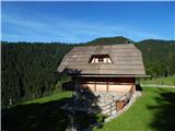 19
19 20
20 21
21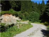 22
22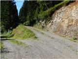 23
23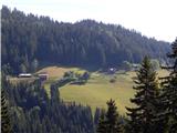 24
24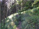 25
25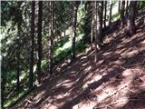 26
26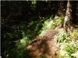 27
27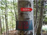 28
28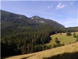 29
29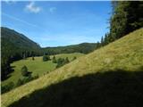 30
30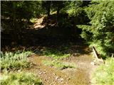 31
31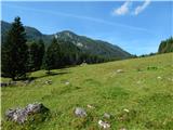 32
32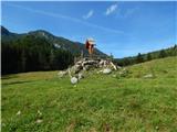 33
33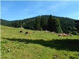 34
34