Muta (Zgornja Muta) - Sveti Urban (above Kozji Vrh)
Starting point: Muta (Zgornja Muta) (381 m)
Starting point Lat/Lon: 46.60949°N 15.16294°E 
Time of walking: 4 h
Difficulty: easy marked way
Difficulty of skiing: no data
Altitude difference: 948 m
Altitude difference (by path): 1085 m
Map:
Access to starting point:
a) From the road Dravograd - Maribor, about 100 meters before the traffic light crossroad by the Tuš supermarket Muta, where there is also a turn-off for Vuzenica, we turn left in the direction of Muta (cemetery to the right). Next follows a short steep ascent, and we arrive at the settlement Zgornja Muta, where in the street Glavni trg, by the manor Graščina Kienhofen, the described path begins. We park at one of the parking lots in the settlement; some parking lots are private, so we must be careful to park in an appropriate place.
b) From the road Maribor - Dravograd, about 100 meters past the traffic light crossroad by the Tuš supermarket Muta, where there is also a turn-off for Vuzenica, we turn right towards Muta (cemetery on the left). Next follows a short steep ascent, and we arrive at the settlement Zgornja Muta, where in the street Glavni trg, by the manor Graščina Kienhofen, the described path begins. We park at one of the parking lots in the settlement; some parking lots are private, so we must be careful to park in an appropriate place.
Path description:
From the center of Zgornja Muta we head on the path towards Pernice and initially walk on the sidewalk of road Gortinska cesta. The settlement and sidewalk end after some time, and we arrive at a crossroad where a road branches off to the right towards Bistriški jarek and sv. Jernej. Here we continue straight and proceed to the next crossroad on a surface intended for pedestrians and cyclists, then at the chapel we turn right onto a side road marked with hiking signs for Pernice.
Here we bypass a nearby company on the right side, then the road turns slightly to the left and leads us past a few more houses. Behind the last house, the road ends, and we continue on a marked grassy path, which leads us past the next chapel to another road, where we turn right. A little further, at two successive crossroads, we continue right, then the path leads us through the yard of nearby houses, and behind them, we begin ascending on a grassy cart track. Higher up, we cross an asphalt road and ascend over a short grassy slope, above which we cross another asphalt road. The path ahead initially follows a wider cart track, which narrows slightly in the forest. After the hunting observatory, we leave the forest, ascending diagonally across a grassy slope, then the path turns right and climbs through a pasture below a nearby farm. We bypass the farm and a newer house on the right side, and after crossing a macadam road, we enter the forest, continuing briefly on a footpath before reaching another road, where we ascend for a short time. The blazes soon guide us slightly right into the forest, where we climb a wider footpath to the next road crossing. The footpath ahead runs parallel to the right side of the road and is slightly exposed, but it is wide enough to pose no significant danger in normal weather conditions. Upon leaving the forest, we make a short crossing to the next road, which we cross to the left, bypassing a nearby farm on the right. We quickly ascend to a designated resting place at 700 meters above sea level, offering a beautiful view of valley Dravska dolina and Pohorje.
The path continues through the forest, where we follow the blazes, leading us along the southeastern ridge of Napečnikov vrh. Just below the mentioned peak, the marked path veers slightly right from the ridge, crossing scenic slopes to a saddle at birch Napečnikova breza, where a view opens up, reaching as far as Kamnik Savinja Alps, with the nearby Peca in Karavanke standing out, and we reach a macadam road.
We don’t walk long on the road, as at the next birch and cross, we turn left onto a footpath that gradually curves right, continuing along the right edge of the forest. Here, we ascend for a few minutes with beautiful views to the right, eastern side, and at 1000 meters above sea level, we re-enter the forest, where we again follow the blazes. A few minutes higher, upon leaving the forest, we bypass a small log cabin on the right, a water trough on the left, and continue along the left side of a nearby forest. Next follows a short ascent on a faintly visible footpath, leading us to Arl's pine (Arlov bor), where another beautiful view opens up.
Right from the pine we return into the forest, and then at the sign we reach the macadam road, which we follow to the right (left the Arl farm). We walk along it for a few minutes, or to the spot where trail markers lead us left onto a footpath, which quickly brings us to the Pernice community center. We bypass the community center on the right side, then continue along the macadam road to a marked crossroad near the former mountaineering cottage Pri Knezu, where there is a registration box. The church of St. Simon and Juda Tadej is located a few steps further below the NOB memorial.
From the crossing by the former mountain hut, we continue towards Košenjak and Sveti Urban, initially ascending through the forest, then the path levels out, and the forest is gradually replaced by partly grassy terrain. A little further, we reach the macadam road which we follow right towards Košenjak, on the nearby crossroad we continue on a slightly left upper road (slightly right farm Zgornji Čiček). A short time we still continue on the road, and then signs for Košenjak point us slightly left on a grassy cart track, on which we continue an ascent. Higher, we go from the mentioned cart track left, few minutes ahead we cross also a rough road. Next follows few minutes of a diagonal ascent, and then we reach the ridge of Kozji vrh, where there is a marked crossing.
From the crossing, we go right (left Kozji vrh less than 1 minute) and we continue on the border ridge, on which we are lightly descending. After a good 10 minutes we step out of the forest, where in front of us we already notice the church of St. Urban, to which we have only a short walk.
Zgornja Muta - Arl's pine 2:30, Arl's pine - Pernice 0:15, Pernice - Kozji vrh 1:00, Kozji vrh - Sveti Urban 0:15.
The description and pictures refer to the condition in November 2018 and 2024.
Pictures:
 1
1 2
2 3
3 4
4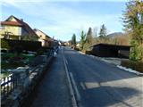 5
5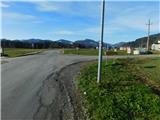 6
6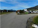 7
7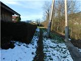 8
8 9
9 10
10 11
11 12
12 13
13 14
14 15
15 16
16 17
17 18
18 19
19 20
20 21
21 22
22 23
23 24
24 25
25 26
26 27
27 28
28 29
29 30
30 31
31 32
32 33
33 34
34 35
35 36
36 37
37 38
38 39
39 40
40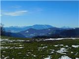 41
41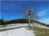 42
42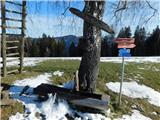 43
43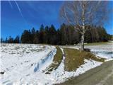 44
44 45
45 46
46 47
47 48
48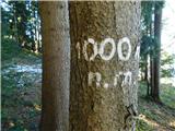 49
49 50
50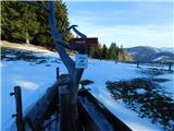 51
51 52
52 53
53 54
54 55
55 56
56 57
57 58
58 59
59 60
60 61
61 62
62 63
63 64
64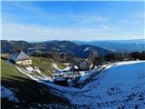 65
65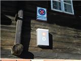 66
66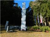 67
67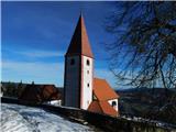 68
68 69
69 70
70 71
71 72
72 73
73 74
74 75
75 76
76 77
77 78
78 79
79 80
80 81
81 82
82 83
83 84
84 85
85 86
86 87
87 88
88 89
89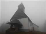 90
90