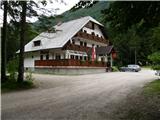
Starting point: Na Razpotju (770 m)
| Latitude/Longitude: | 46,392°N 14,6273°E |
| |
Walking time: 5 h
Difficulty: difficult marked way
Elevation gain: 1622 m
Elevation difference along the route: 1645 m
Map: Kamniške in Savinjske Alpe 1:50.000
Recommended equipment (summer): helmet
Recommended equipment (winter): helmet, ice axe, crampons
Views: 13.942
 | 2 people like this post |
Access to starting point:
We drive to Luče (from Mozirje or via Kranjski rak) and continue towards Logarska dolina. Soon after the village Solčava we come to the intersection, where the road to Logarska dolina branches off to the left. We turn left towards Logarska dolina (toll payment) and drive along the road to the signs for the mountain hut at Klemenča jama. We park on the parking lot near the guesthouse Na Razpotju. In front of the guesthouse only guests are allowed to park.
Route description:
From the parking lot, we head onto the forest road in the direction of Klemenča jama. After a few minutes of walking, a wide path branches off to the left towards Klemenča jama. We take this path, which starts to ascend. A fairly steep path soon brings us to steep slopes, where with the help of a steel cable we cross a slightly exposed gully. The path, which continues ascending, soon brings us to the spot where a wall blocks the path. In front of us we spot a cave and above it a mark that directs us into the cave. When we step into the cave, we see that it is not a cave, but a nicely made tunnel through which we continue. In the tunnel, a steel cable assists us, though we need it more on the descent than on the ascent. On the other side, along a wide path in a gentle ascent, we cross an exposed ledge. The path ahead goes into the forest and continues ascending on steep slopes that are dangerous for slipping when wet. Further on, over a small bridge, we cross another gully, then the path brings us to a less steep section where the path from Dom Planincev joins. We continue slightly upwards on a wide path that soon takes us out of the forest. Only a short ascent remains on the grassy slope to the mountain hut at Klemenča jama.
From the hut, we continue straight towards Ojstrica on the path that enters the forest after a few dozen meters. The path, which ascends moderately to steeply through the forest, brings us higher below rocky cliffs that are not overly crumbly. The path then veers right away from the cliffs and leads to a junction, where we continue straight towards Škarje, while to the left branches the very demanding Kopinškova pot to Ojstrica. The path continues crossing the slopes towards the west, then emerges from the forest and turns slightly left. Here it begins to ascend somewhat more steeply along scree, then turns right and climbs towards the saddle below Rjavčki vrh (1898m). From the marked path to Rjavčki vrh there is about 10 minutes of ascent on pathless terrain. At the saddle, a path also branches right leading down the valley towards Koča pod slapom Rinka. The path from the saddle then turns left, first ascending past some dwarf pines and then across scree. A somewhat steeper ascent follows on rocky terrain towards the saddle Škarje (2141m).
At the saddle Škarje, an inscription on the rock directs us right. The path ascends steeply and shifts somewhat to the south side of the ridge. We approach the ridge again and ascend on a partly grassy slope. The path then bypasses the summit of Baba (Lučka Brana 2244m), which is just a few minutes' ascent from the marked path. The path becomes less steep and later descends slightly while crossing the south slopes. At the end, the path turns left and becomes somewhat more demanding for a short time. In the ascent, we cross steep slopes below the summit of Planjava, then reach a junction where we join the other paths to Planjava. At the junction, we head right, followed only by a short ascent on the summit slope of the mountain.
Na Razpotju - Klemenča jama 1:10, Klemenča jama - Planjava 3:50.

Photos:
 1
1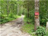 2
2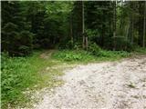 3
3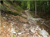 4
4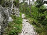 5
5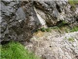 6
6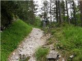 7
7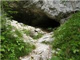 8
8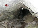 9
9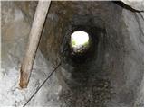 10
10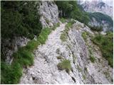 11
11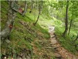 12
12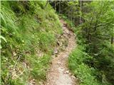 13
13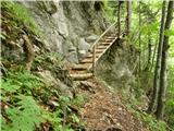 14
14 15
15 16
16 17
17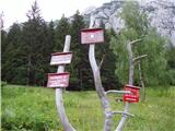 18
18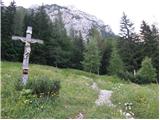 19
19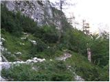 20
20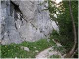 21
21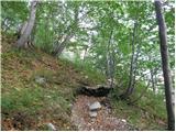 22
22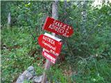 23
23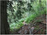 24
24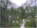 25
25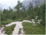 26
26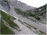 27
27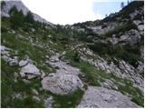 28
28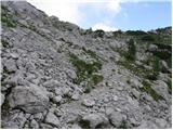 29
29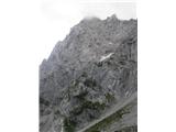 30
30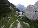 31
31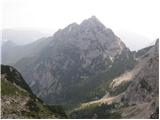 32
32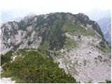 33
33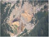 34
34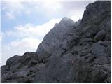 35
35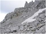 36
36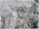 37
37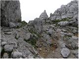 38
38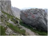 39
39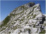 40
40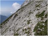 41
41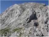 42
42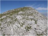 43
43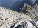 44
44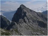 45
45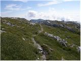 46
46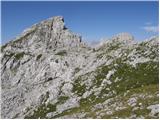 47
47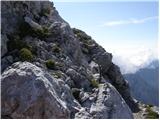 48
48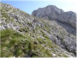 49
49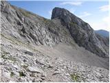 50
50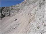 51
51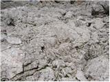 52
52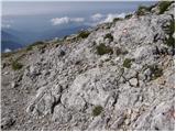 53
53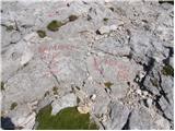 54
54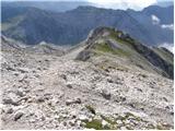 55
55 56
56
Discussion about the trip Na Razpotju - Planjava
|
| seinfeld8. 08. 2016 |
Yesterday we did this path. Quite demanding, mostly steep, markings poorly visible in places. On the path (photo 27) there is a larger snowfield, hard snow in the morning, we went under it. This snow won't melt this year. The upper photos of the path are quite forgiving, from the screes onwards the path is exposed in some places.
Up and down is over 12km, it took us 7.5 hours.
|
|
|
To post a comment you must log in:
If you do not yet have a username, you must first
register.