Nassfeld - Kronalpe / Monte Corona (Auernig Höhenweg)
Starting point: Nassfeld (1540 m)
Starting point Lat/Lon: 46.5609°N 13.2758°E 
Path name: Auernig Höhenweg
Time of walking: 3 h 30 min
Difficulty: difficult marked way
Difficulty of skiing: no data
Altitude difference: 292 m
Altitude difference (by path): 660 m
Map: Tabacco 18
Access to starting point:
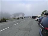
Over a border crossing in Rateče we drive through Trbiž / Tarvisio, Ukve / Ugovizzo to the settlement Tablja / Pontebba, where we turn right following the signs »Passo di Pramollo / Nassfeld« (Slovenian Mokrine). On the mountain pass, we drive past the lake on the Austrian side, where we park on a large parking lot.
Path description:
From the parking lot, we walk to the border crossing where, on the Austrian side, we turn left onto a narrower ascending asphalt road. At the beginning of the mentioned road, there are also signposts. The road then leads us past a memorial chapel and crosses a fence. The road then flattens and brings us to a marked crossing.
We continue right onto a footpath where the signs for the Auernig Höhenweg also direct us. From the crossing, we start ascending more steeply on a slope covered with grass and some bushes. The path also leads us through a strip of sparse forest. Trees become increasingly sparse, and from the path, beautiful views open up on the surrounding peaks. The path then brings us to a marked crossing where a path from the Plattner cottage joins from the left.
We continue right and ascend on a slope covered with grass and sparse trees. After a short ascent, the path brings us to a bench from where there is a very beautiful view of the surrounding peaks above Mokrine. The path here turns slightly to the right and then leads us through dwarf pines, bringing us to a marked crossing below the summit Auernig (Javornik).
Right is only a short ascent through dwarf pines to the top of Javornik, but we continue straight on the Auernig Höhenweg path. From the crossing, the path becomes gentler and continues running through dwarf pines. The path then starts descending along a wide ridge, mostly covered with dwarf pines. This path then leads us to a marked crossing at the Auernig Sattel saddle.
To the right, a path leads downwards towards the Javornik mountain pasture, but we continue straight towards the summit of Krniška gora (Italian Monte Carnizza, German Garnitzenberg). From the crossing, we initially ascend along the ridge covered with bushes and dwarf pines; later, the path veers to the right, following an ascent on a grassy slope back towards the ridge. Further, we then walk along a slightly narrower and mostly grassy ridge. After a short descent, a path branches off to the left towards the upper station of the Gartnerkofel cableway.
We continue along the scenic border ridge, where we briefly ascend through a band of dwarf pines. Only a short ascent on a grassy ridge remains to reach the summit.
From the top, we continue straight and start slightly descending on a grassy ridge, which becomes somewhat narrower. Next follows a shorter, steeper descent through slightly more rocky terrain, alongside which there is increasingly more dwarf pine. On this part also some caution is needed. Further, we descend gently for some time through dwarf pine on a wide and somewhat less distinct border ridge. Soon, we start ascending again, and the ridge becomes steeper once more. Initially, we veer to the left side of the ridge, followed by a steeper ascent to an unnamed peak in the ridge. On this part, a steel cable is also available for assistance. Further follows a descent through dwarf pine and bushes, from which beautiful views of the surrounding peaks still open up. Such a path leads us to more grassy terrain, and soon we reach the saddle Vrh Krnice.
On the saddle where there is a marked crossing we cross a macadam road and we continue in the direction of the peak Kronalpe (Koren). From the crossing, we start ascending on a footpath which at first runs mostly through dwarf pines, and higher brings us on a more grassy terrain. The footpath here becomes a little worse beaten and it turns to the right and it is ascending on a grassy slope surrounded with some dwarf pines and rocks. Since the path is worse beaten we have to pay attention to blazes. On such a path we then soon reach the panoramic peak.
We can descend on the southern side to the mountain pasture V Pečeh (ita. Casera For, in German Kronalm) and from there on the macadam road back to the starting point at the Mokrine pass. We can also return along the ascent route to the saddle Vrh Krnice and from there descend to the mountain pasture V Pečeh. From the saddle Vrh Krnice we can also return to the starting point via the northern Austrian side of the ridge over the mountain pasture Krnica (Garnitzen Alm).
Pictures:
 1
1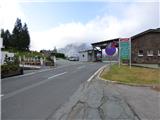 2
2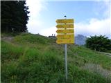 3
3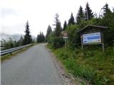 4
4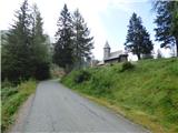 5
5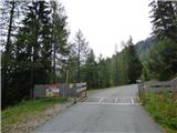 6
6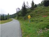 7
7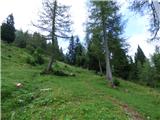 8
8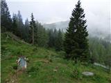 9
9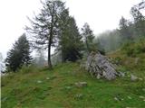 10
10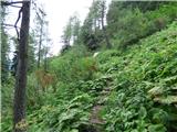 11
11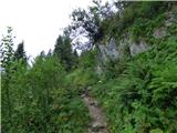 12
12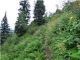 13
13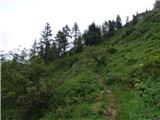 14
14 15
15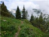 16
16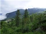 17
17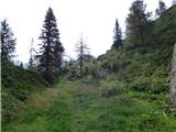 18
18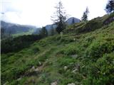 19
19 20
20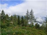 21
21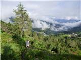 22
22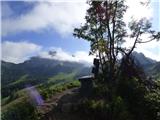 23
23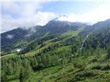 24
24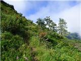 25
25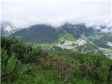 26
26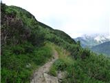 27
27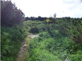 28
28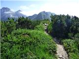 29
29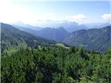 30
30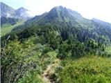 31
31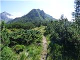 32
32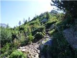 33
33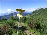 34
34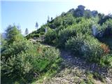 35
35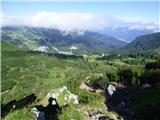 36
36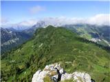 37
37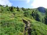 38
38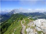 39
39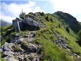 40
40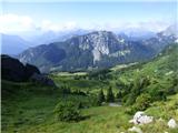 41
41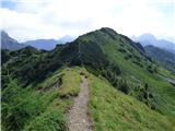 42
42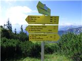 43
43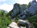 44
44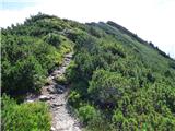 45
45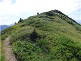 46
46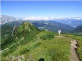 47
47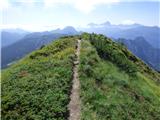 48
48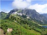 49
49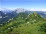 50
50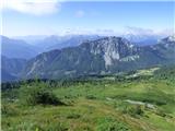 51
51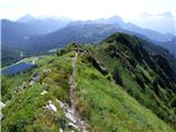 52
52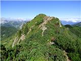 53
53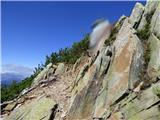 54
54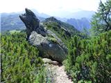 55
55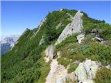 56
56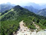 57
57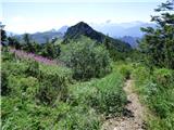 58
58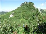 59
59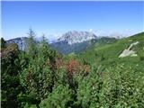 60
60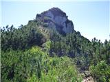 61
61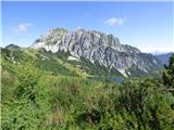 62
62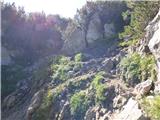 63
63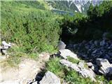 64
64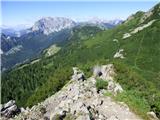 65
65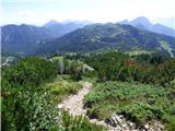 66
66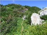 67
67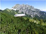 68
68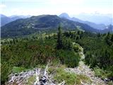 69
69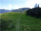 70
70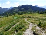 71
71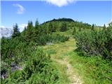 72
72 73
73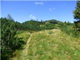 74
74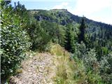 75
75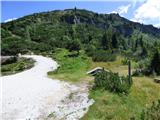 76
76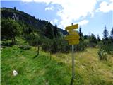 77
77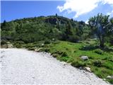 78
78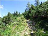 79
79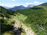 80
80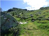 81
81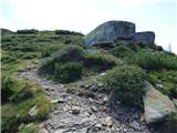 82
82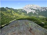 83
83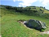 84
84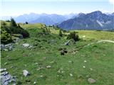 85
85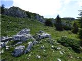 86
86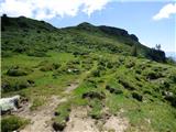 87
87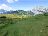 88
88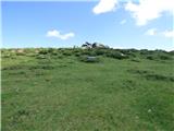 89
89 90
90 91
91 92
92 93
93 94
94