Pevno - Sveti Križ (Križna Gora)
Starting point: Pevno (403 m)
Starting point Lat/Lon: 46.1901°N 14.2995°E 
Time of walking: 2 h 10 min
Difficulty: easy marked way
Difficulty of skiing: no data
Altitude difference: 277 m
Altitude difference (by path): 465 m
Map: Škofjeloško in Cerkljansko hribovje 1:50.000
Access to starting point:
A) We drive to Medvode, and then continue driving towards Škofja Loka. We then drive through Škofja Loka, and a little after the main bus station, on the part where the main road turns slightly to the left, we continue slightly right in the direction of the settlement Pevno. A little further, at the marked crossroad we go right in the direction of Crngrob and Pevno, and at the next one left in the direction of papirnica, Crngrob and Pevno. Škofja Loka soon ends after that, and the road further leads us through meadows. At the crossroad, where the road slightly branches off to the right towards Papirnica, we continue slightly left, at the next crossroad, by the wooden sign left towards the settlement Pevno (straight Crngrob). There follows another few hundred meters of driving and the road brings us to Pevno, where we notice the first blazes. At the starting point there are no arranged parking places.
B) From Žiri or Cerkno we drive to Škofja Loka, from there we continue left towards Železniki. We then drive through Škofja Loka, and a little after the main bus station, on the part where the main road turns slightly to the left, we continue slightly right in the direction of the settlement Pevno. A little further, at the marked crossroad we go right in the direction of Crngrob and Pevno, and at the next one left in the direction of papirnica, Crngrob and Pevno. Škofja Loka soon ends after that, and the road further leads us through meadows. At the crossroad, where the road slightly branches off to the right towards Papirnica, we continue slightly left, at the next crossroad, by the wooden sign left towards the settlement Pevno (straight Crngrob). There follows another few hundred meters of driving and the road brings us to Pevno, where we notice the first blazes. At the starting point there are no arranged parking places.
C) From Železniki we drive to Škofja Loka, and then before the road turns somewhat right and starts descending towards the main bus station, we continue left in the direction of the settlement Pevno. A little further we arrive at the next marked crossroad, where we continue right, this time in the direction of the settlements Pevno and Crngrob. A few more crossroads follow, and we continue to follow the signs for Crngrob and Pevno. Škofja Loka soon ends after that, and the road further leads us through meadows. At the crossroad, where the road slightly branches off to the right towards Papirnica, we continue slightly left, at the next crossroad, by the wooden sign left towards the settlement Pevno (straight Crngrob). There follows another few hundred meters of driving and the road brings us to Pevno, where we notice the first blazes. At the starting point there are no arranged parking places.
D) First we drive to Kranj, from there we continue driving towards Škofja Loka. Still before arriving in Škofja Loka, in the settlement Dorfarje we continue right in the direction of the settlement Crngrob. First we drive past the furniture salon Prevc, then past the turn-off to the farm pri Brojanu, further past the tree nursery Cegnar and Zakotnik, after which the quite narrow road that runs through the village widens somewhat. After the village a short descent follows and the path leads us past a larger parking lot, which is located by the shooting range of the Slovenian army. After the parking lot we cross the stream Ušovca, the road passes into the forest and starts to ascend moderately. Along the asphalt road we then quickly arrive in the settlement Crngrob, where we bypass the church and a few houses on the left side. Further we drive through the forest, where the road leads us past Rdeče znamenje, when the forest ends we drive between fields. At the nearby crossroad we go right and past the church of sv. Uršula we drive to the center of the settlement Pevno, where we notice the first blazes. At the starting point there are no arranged parking places.
Path description:
From the spot where we notice the first blazes, the path leads us along a side road which at the hydrant splits into two parts. We continue on the lower road which gradually changes into a cart track, which turns right and ascends to the edge of the forest. At the edge of the forest we choose the right path, along which there are also blazes, and the path passes into the forest, where a little higher it returns to a wider cart track. We continue on the forested cart track which at first rises quite gently, then moderately. At the junctions we follow the blazes or signs for Planica. Higher the cart track becomes steeper and temporarily passes onto a shorter steep slope. Above the mentioned part we reach a wider cart track which brings us out of the forest onto a grassy slope below the settlement Planica. With nice views towards the valley and the Alps we quickly reach a smaller settlement, where at the crossroad we continue left (right peak Planica).
We continue in the direction of Križna Gora, on the road which soon leaves the village, then ascends diagonally across a grassy slope. When the traverse ends we arrive at some kind of ridge, where we continue right, then with nice views we continue past a few more houses. Higher we reach the main ridge, where we continue sharply left onto a cart track which starts to descend lightly (right along the road peak Planica).
The cart track soon descends even steeper, then brings us out of the forest onto a panoramic grassy slope, from which a nice view opens up onto part of Škofjeloško hribovje (view of the hills from Lubnik across Stari vrh to Blegoš). Across the panoramic slope the path ascends lightly, then returns to the forest, through which it starts descending again. Lower we reach a macadam road, which we follow straight ahead, on it lightly ascending to the nearby bus turning point. At the NOB monument we again emerge from the forest, then descend along an asphalt road to a relatively new and nicely arranged parking lot, which is located above the village Križna Gora.
From there still some descent follows, then past the turn-off of the path to the settlement Praprotno, we arrive at a crossroad in the middle of the village Križna Gora, from where we continue right in the direction of the church and the hunting lodge. We continue on a quite panoramic and at first still asphalt road, which gently ascends towards the high-voltage power line. After the power line the road flattens, or even descends slightly, then a footpath branches off to the left from it, leading directly towards the church Sv. Križa.
We continue on the mentioned footpath which runs parallel to the road and on which we arrive at the already mentioned little church in a few minutes.
From the little church, from where a nice view opens up, we continue on a well-trodden path which continues somewhat to the right and returns to the road which we left shortly before. When we step onto the road we continue slightly left and in one minute of further walking arrive at the hunting lodge, which is located at the edge of the forest.
Pevno - village Planica 1:15, village Planica - Sveti Križ 55 minutes.
Pictures:
 1
1 2
2 3
3 4
4 5
5 6
6 7
7 8
8 9
9 10
10 11
11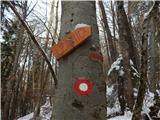 12
12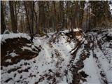 13
13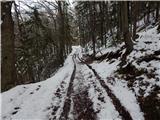 14
14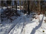 15
15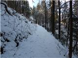 16
16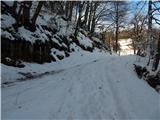 17
17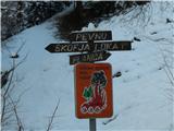 18
18 19
19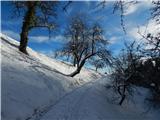 20
20 21
21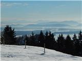 22
22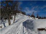 23
23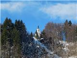 24
24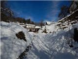 25
25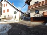 26
26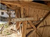 27
27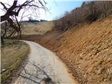 28
28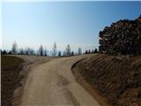 29
29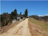 30
30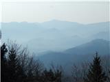 31
31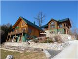 32
32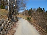 33
33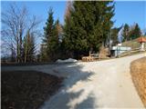 34
34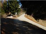 35
35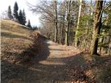 36
36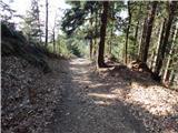 37
37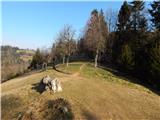 38
38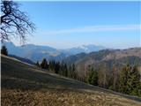 39
39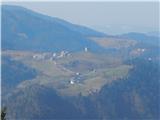 40
40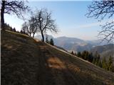 41
41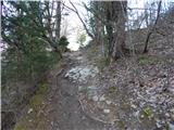 42
42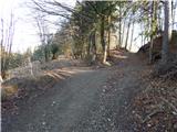 43
43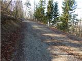 44
44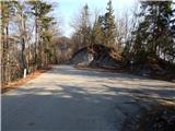 45
45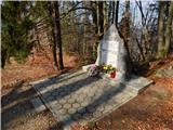 46
46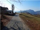 47
47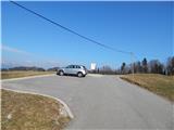 48
48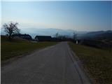 49
49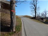 50
50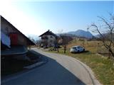 51
51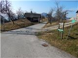 52
52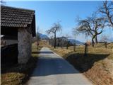 53
53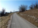 54
54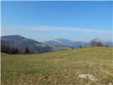 55
55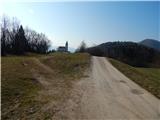 56
56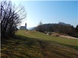 57
57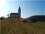 58
58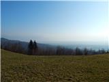 59
59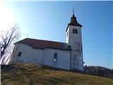 60
60 61
61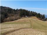 62
62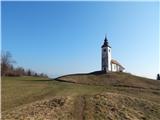 63
63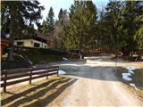 64
64 65
65