Planina Vetrh - Storžič (via Javorniški preval)
Starting point: Planina Vetrh (1185 m)
Starting point Lat/Lon: 46.3967°N 14.3858°E 
Path name: via Javorniški preval
Time of walking: 3 h 20 min
Difficulty: easy unmarked way, difficult marked way
Difficulty of skiing: no data
Altitude difference: 947 m
Altitude difference (by path): 1050 m
Map: Karavanke - osrednji del 1:50.000
Access to starting point:
A) First, we drive to Tržič, and then we continue driving towards Dovžanova soteska. Towards the end of Tržič we leave the road towards Dovžanova soteska and we continue driving right in the direction of Lom pod Storžičem. Above Lom pod Storžičem, at the right hairpin turn we leave the main road which leads higher towards Grahovšam and Dom pod Storžičem and we continue driving left in the direction of the settlement Potarje. On the asphalt road, we drive to the crossroad below the tourist farm pr Tič, where we continue left towards the mountain pasture Konjščica. Next follows driving on a macadam road, from which soon a road towards the farm Pinč branches off to the left. Here we go right on the upper road which becomes visibly worse, and on it we drive for quite some time to the next crossroad. From the crossroad, we continue straight on the lower road (right upward mountain pasture Konjščica), which a little ahead crosses the stream Vetrnik. At the next crossroad, we go left, and after 50 meters we park on the marked parking lot on the edge of the mountain pasture Vetrh. From the crossroad at the factory Lepenka in Tržič to the starting point it is approximately 11 km, of which 6 km macadam.
B) First, we drive to Tržič, and then we continue driving towards Dovžanova soteska. Further, we drive through Dovžanova soteska, Dolina, to Jelendol, where at the triangular crossroad we continue on the right road towards Medvodju. A few kilometers ahead a road towards the mountain pasture Zali potok branches off to the left, and by Tržiška Bistrica we drive for some more time, more precisely to the first drivable road to the right, which over a bridge crosses Tržiška Bistrica. After the bridge, we start ascending on a worse macadam road which on individual sections is often in quite bad condition. At the crossroads we continue straight, and then, when the road flattens, we quickly arrive at the marked parking lot on the edge of the mountain pasture Vetrh, where we park. From the crossroad at the factory Lepenka in Tržič to the starting point it is approximately 12.5 km, of which 3.7 km very bad macadam road, and there is some more macadam.
Path description:
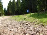
On the eastern side of the parking lot, we notice a cart track which ascends through the forest to the nearby forest road, which we follow to the left. Along the road we quickly arrive at the right hairpin turn, from which a nice view opens up towards Košuta, Plešivec and surrounding mountains. In the continuation, first among the trees some view still opens up, then the path passes into a quite dense forest, through which it ascends on the western slopes of Pečica (1421 m) and later Maljevec (1502 m). On the slopes of Maljevec we do not walk long, as the road brings us into the small valley of the stream Vetrnik. Over the bridge the road quickly passes to the left bank of the stream, then we ascend directly along the stream for a few minutes. When higher the road crosses the stream once again (this time without a bridge), we leave it and before crossing the stream we continue right onto a wider cart track which starts ascending through the forest. At the fork of cart tracks we continue slightly left, then a few minutes higher we return to the macadam road, which we follow to the right.
While walking along the road we quickly arrive at the marked junction, from which we continue straight in the direction of the mountain pasture Javornik (right Bela peč, mountain pasture Konjščica and cottage pr Zdravc). From the junction we continue along the cart track, then through a belt of forest we ascend to the mountain pasture Javornik, which we reach after a few minutes of further walking.
From the mountain pasture Javornik we continue right in the direction of Javorniški preval (left Stegovnik) and continue along the scenic cart track. The wide cart track, which descends transversely, brings us lower into the forest, a little further to the marked junction at Javorniški preval.
From the mentioned saddle we continue straight in the direction of Storžič (sharply left Stegovnik east path, slightly left Kanonir and Tržiški graben, right Dom pod Storžičem) and continue along the path which slightly ascends through the forest. In the continuation the initially still gentle path quickly leads us to the steep slopes of Škarjeva peč, over which we ascend transversely for some time, then the path turns slightly to the left and starts to ascend steeply. A transverse ascent to the right follows, where due to the steepness and often wet ground a steel cable assists us. An ascent along the steel cable follows, and at some places staples and pegs also assist us. The secured section ends after a few minutes, and the path continues transversely for some time across occasionally quite steep slopes. Higher some views occasionally open up, the slope becomes less steep, and the path brings us to a marked junction where we join the visibly better-trodden path from Dom pod Storžičem - the path over Škarjev rob.
We continue straight, then ascend transversely along the western slopes of the ridge Škarjev rob, from where we have a nice view towards the path ahead of us and Storžič. Higher the path brings us onto the mentioned ridge, from which a view also opens onto the Jezersko side, where we can nicely see the highest peaks of the Kamniško Savinjske Alpe. In the continuation we ascend through a belt of dwarf pines, then pass onto scree fields where in early summer we can still encounter snow patches. An ascent along the edge of the scree follows, then we arrive at the technically more demanding section of the path, where we first cross a slightly exposed gully (if it is under snow without using winter equipment there is a great risk of slipping), then ascend a steep small valley which is exposed to falling rocks. In the upper part of the small valley fixed protections assist us, and the path then turns somewhat to the right. Approximately 10 more minutes of ascent follow on a quite steep slope and the increasingly scenic path brings us to the summit of Storžič.
Pictures:
 1
1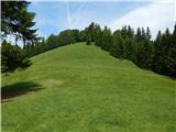 2
2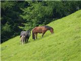 3
3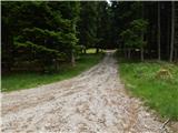 4
4 5
5 6
6 7
7 8
8 9
9 10
10 11
11 12
12 13
13 14
14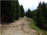 15
15 16
16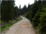 17
17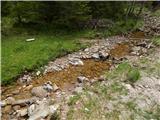 18
18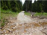 19
19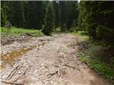 20
20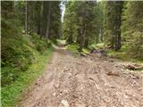 21
21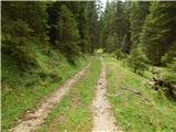 22
22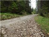 23
23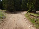 24
24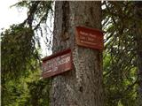 25
25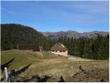 26
26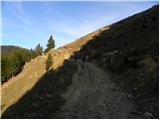 27
27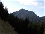 28
28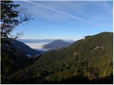 29
29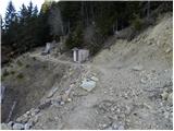 30
30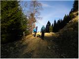 31
31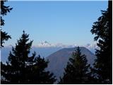 32
32 33
33 34
34 35
35 36
36 37
37 38
38 39
39 40
40 41
41 42
42 43
43 44
44 45
45 46
46 47
47 48
48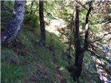 49
49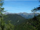 50
50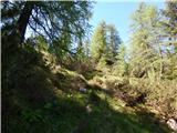 51
51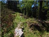 52
52 53
53 54
54 55
55 56
56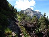 57
57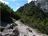 58
58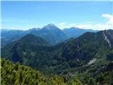 59
59 60
60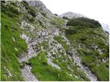 61
61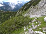 62
62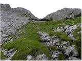 63
63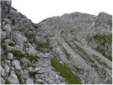 64
64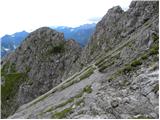 65
65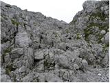 66
66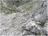 67
67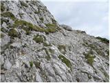 68
68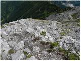 69
69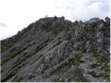 70
70 71
71