Planina Zapleč - Krasji vrh (via Koluji)
Starting point: Planina Zapleč (1201 m)
Starting point Lat/Lon: 46.2833°N 13.6308°E 
Path name: via Koluji
Time of walking: 2 h
Difficulty: easy marked way
Difficulty of skiing: easily
Altitude difference: 572 m
Altitude difference (by path): 572 m
Map: Julijske Alpe - zahodni del 1:50.000
Access to starting point:
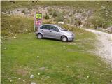
From Tolmin or Bovec we drive to Kobarid, from there we follow the road in the direction of Drežnica (the turn-off is from the Kobarid bypass). We continue over the bridge across the Soča River and immediately after the bridge we turn left in the direction of Drežnica. In Drežnica we come to an intersection, where the road to the village Magozd branches off to the left, and we continue a little further to the next intersection, where we turn left in the direction of Drežniške Ravne. The road then brings us to an intersection in Drežniške Ravne, where we turn right uphill in the direction of Krasji vrh. At the next intersection we again turn right and follow the road to the water trough, where the asphalt ends. We then follow the macadam road for quite a few kilometers to the parking lot by the road in front of the TNP sign and the grazing fence.
Path description:
From the parking lot in front of the TNP sign we continue on the macadam road ahead, which below the slopes of the ridge Krnčica soon brings us to an intersection on the mountain pasture Zaprikraj. Here we continue left on the worse lower road, which in a few steps brings us to the hamlet on the mountain pasture.
From the buildings on the mountain pasture we continue on a path that slightly ascends in the direction of Krasji vrh. The path then at the end of the mountain pasture crosses a grazing fence and through the forest brings us to a clearing where a hunting cottage stands. The path ahead continues on a cart track, which goes back into the forest and soon brings us to a junction. We leave the cart track and head left slightly downhill. There follows a few minutes of almost level walking, then we join the footpath from Drežniške Ravne. The path then moderately ascends on slopes covered with forest. The path ahead crosses a clearing where high grass grows and then ascends again to a junction at 1450 m.
We continue left in the direction of the kolujev and follow the path, which for 15 minutes proceeds without major changes in elevation. After 15 minutes the path brings us out of the forest and begins to moderately ascend on the summit slopes of Krasji vrh. Soon the path brings us to a junction, where we continue right, left to koluji 10 min. The path ahead becomes quite overgrown and ascends among high grasses all the way to the top.
Pictures:
 1
1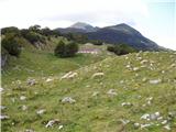 2
2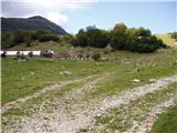 3
3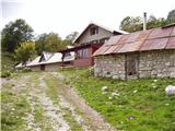 4
4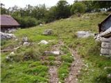 5
5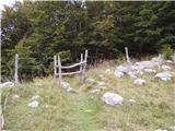 6
6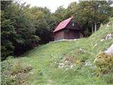 7
7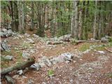 8
8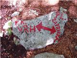 9
9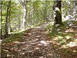 10
10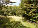 11
11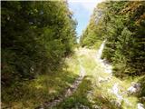 12
12 13
13 14
14 15
15 16
16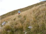 17
17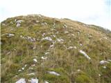 18
18 19
19