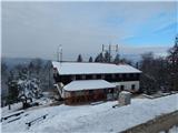
Podvin pri Polzeli - Gora Oljka (lower path)
Starting point: Podvin pri Polzeli (354 m)
Starting point Lat/Lon: 46.2931°N 15.0679°E 
Path name: lower path
Time of walking: 1 h 30 min
Difficulty: easy marked way
Difficulty of skiing: no data
Altitude difference: 379 m
Altitude difference (by path): 395 m
Map:
Access to starting point:
We leave Štajerska highway at exit Šempeter, and then we follow the signs for Polzela. Through Polzela we follow the main road, after that at pizzeria and inn AS caffe we continue right on street Pot na Vimperk 3-16. We continue past individual houses, and then asphalt road starts considerably ascending. At the farm Cizej-Sevšek we get to the settlement Podvin pri Polzeli, where at the crossroad we go right, and also a little further we get to the parking lot where we park.
Path description:
From the parking lot, we go in the direction of Gora Oljka and we continue on the asphalt road. We at first walk through the forest and then past few houses. Further, we walk by the edge of the forest, and the road brings us to a marked crossroad, where a road branches off to the left towards birth house Neža Maurer and the path on Gora Oljka past the mentioned house, and we continue straight. A little further, we leave the asphalt road, because signs for Gora Oljka point us to the left on a cart track which at first leads by the edge of a meadow, and then turns right and takes us into the forest. Few minutes we walk through the forest, where we follow the blazes, and when we reach narrower asphalt road we cross it towards the left. Next follows shorter a little steeper ascent, and then we reach another road, where we continue right (here we join "upper" path and the path past the birth house of Neža Maurer).
The path ahead leads us by nice views, higher by the former inn Jug joins also the path from Podgora and one of the paths from Andraž nad Polzelo.
We continue on the road, when we notice signs for Gora Oljka, which point us left on a footpath, we still continue on the road, and we leave the road few minutes higher, where smaller stairs and blazes point us on a footpath. Next follows a diagonal ascent through the forest, and when we reach the cart track we go right. A little further, the cart track joins the road, and few steps earlier we leave it and we continue slightly left and join the road a little higher and even then only for few steps, because then blazes again lead left in the forest. We quickly join a wider path, which we follow to the left, and at the crossing of marked paths we go right, and then we quickly ascend to the mountain hut on Gora Oljka, from which we ascend on stairs also to the church of the Holy Cross.
Description and pictures refer to a condition in the year 2019 (January).
On the way: Jug (530m)
Pictures:
 1
1 2
2 3
3 4
4 5
5 6
6 7
7 8
8 9
9 10
10 11
11 12
12 13
13 14
14 15
15 16
16 17
17 18
18 19
19 20
20 21
21 22
22 23
23 24
24 25
25 26
26 27
27 28
28 29
29 30
30 31
31 32
32 33
33 34
34 35
35 36
36 37
37 38
38 39
39