Polhov Gradec - Polhograjska Grmada (via Ravnek and Mala Grmada)
Starting point: Polhov Gradec (365 m)
Starting point Lat/Lon: 46.065°N 14.3167°E 
Path name: via Ravnek and Mala Grmada
Time of walking: 1 h 30 min
Difficulty: easy marked way
Difficulty of skiing: demanding
Altitude difference: 533 m
Altitude difference (by path): 575 m
Map: Ljubljana - okolica 1:50.000
Access to starting point:
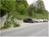
From Dobrova, Horjul, Gorenja vas or Črni Vrh we drive to Polhov Gradec, more precisely to a crossroad next to the main bus station in Polhov Gradec. We park at a suitable place near the station, best on the parking lot by the bridge over the river Božna.
Path description:
From the starting point we continue for a short time by the main road in the direction of Ljubljana, after that behind the inn Gostilna pri Pratkarju we notice mountain signposts for Grmada, Belica, Katarina and Tošč, which point us to the left, on the path which continues by the brick fence. After a short ascent, we step on an asphalt road and we follow it to the right, but we walk only a few steps on it, because then blazes lead us left, on at first still quite wide path. The path, from which a nice view opens up on Polhov Gradec and St. Lovrenc, then passes into the forest and for some time mostly ascends diagonally. Higher, we stride across the riverbed of Frjetov graben, and then in a few steps we ascend to a meadow, where the path leads by a wooden fence. The path through the meadow quickly brings us to a macadam road which we follow to the right, and in a minute or two of additional walking we arrive at the mountain hut Planinski dom na Ravneku.
For a short time we still continue on the road, after that the marked path crosses it a few times. Higher, we return to the road, and it brings us to the hamlet Ravnek, where behind the last house we arrive at a smaller crossroad, where we continue slightly right (slightly left St. Uršula).
Only about 10 steps ahead the road again splits, and this time we continue slightly left (slightly right unmarked path to Kucelj).
The path, which meanwhile from the road has turned into a pleasant footpath, brings us higher to the next junction, where from the right joins the path from the village Dvor. We continue left on the wide path, which after a few minutes of additional walking brings us to the hunting cottage, where the path splits into two parts.
From the hunting cottage we continue in the direction of Grmada over Mala Grmada (the right "direct path" is also approximately equally long in time) on an increasingly steep path, which starts ascending on and along an occasionally very panoramic ridge. Higher the path brings us to the forepeak of Grmada, where from the left joins another path from Polhov Gradec (over Setnica and also the path past St. Uršula).
The path ahead first descends, then passes onto a diverse ridge, along which it continues with some shorter ascents and descents. The path then leaves the ridge and turns somewhat to the right, where it starts ascending more steeply again. We follow this path, to which paths from Belica and Topola also join (also the direct path from Polhov Gradec past Ravnek), all the way to the panoramic summit.
Trip can be extended to: Tošč
Pictures:
 1
1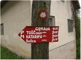 2
2 3
3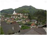 4
4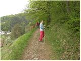 5
5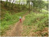 6
6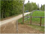 7
7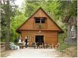 8
8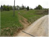 9
9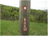 10
10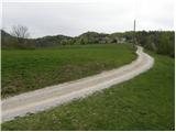 11
11 12
12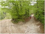 13
13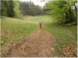 14
14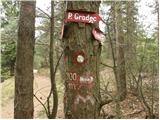 15
15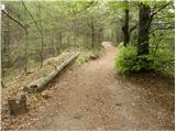 16
16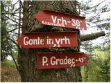 17
17 18
18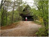 19
19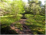 20
20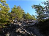 21
21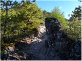 22
22 23
23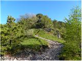 24
24 25
25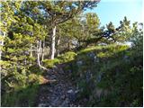 26
26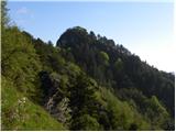 27
27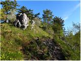 28
28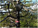 29
29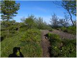 30
30 31
31 32
32 33
33 34
34 35
35 36
36 37
37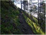 38
38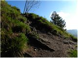 39
39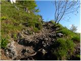 40
40 41
41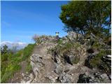 42
42 43
43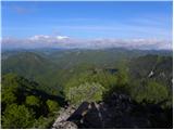 44
44