Starting point: Povlje (710 m)
Starting point Lat/Lon: 46.3296°N 14.3768°E 
Time of walking: 1 h 45 min
Difficulty: easy marked way
Difficulty of skiing: no data
Altitude difference: 615 m
Altitude difference (by path): 620 m
Map: Karavanke - osrednji del 1:50.000
Access to starting point:
a) From the Ljubljana - Jesenice motorway, take the Brnik exit, and when you reach the Mengeš - Kranj road, continue left towards Kranj. Drive along the main road towards Kranj to the first roundabout, from which continue on the first right exit towards Šenčur. Continue through Šenčur on the main road, then, when you reach the Kranj - Zgornje Jezersko road, turn right towards Jezersko. When you arrive in Preddvor, leave the main road and continue driving left towards the centre of the mentioned place, from there follow the signs to the Bašelj settlement. Just after the Bašelj settlement, the road descends to the Milka stream and crosses it over a bridge. Here, a road first branches off to the right to the villages Babni Vrt, about 100 m further to the village Povlje. Continue on the ascending road towards Povlje, and park on a small parking lot above the village. At the starting point there is a small intersection, several hiking signposts and a large information board of the Trstenik walking-educational trail "path under Storžič".
b) From the Jesenice - Ljubljana motorway, take the Kranj west exit, then continue driving towards Golnik. When you arrive in Tenetiše, leave the main road towards Golnik and continue driving right towards Trstenik. Approximately 1 km after the Trstenik settlement, arrive at a small intersection, where continue left towards the village Povlje. Continue on the ascending road towards Povlje, and park on a small parking lot above the village. At the starting point there is a small intersection, several hiking signposts and a large information board of the Trstenik walking-educational trail "path under Storžič".
Path description:
From the parking lot, head to the left road towards Velika and Mala Poljana (the path between the two roads leads to Planina Javornik, also Dolenčeva path to Velika Poljana). The road soon turns left, leading us past a water tank and a quarry. A bit further, the road turns into a cart track, which temporarily ascends more steeply. Just after the cart track levels out and turns right into the forest, a marked footpath branches off even further to the right from it, on which we continue the ascent. For a short time, we continue ascending along the torrent, then the path turns left and ascends transversely, in the last part over a somewhat collapsed gully. At the top of the gully, we step onto a kind of ridge between two streams, where the path from the villages Goriče and Zalog joins us from the left. A short ascent follows along the scenic ridge, then we arrive at a marked junction, from which we continue on the lower left path towards Mala Poljana (right Velika Poljana).
We continue on the path, which after a few more steps brings us into a forest-covered valley. The increasingly faintly visible path continues ascending through the mentioned valley, which becomes narrower and gradually turns into a ravine. Further, we ascend on the barely visible path, which climbs between two steep slopes. The path, which is mainly covered with leaves and exposed to falling rocks in certain sections, leads us higher to an initially quite eroded cart track, along which in a few minutes we exit the forest to the lower part of Mala Poljana. The cart track, along which we continue the ascent, brings us after a few more minutes of walking to the hunting hut on Mala Poljana.
Starting point - Gmajna 0:25, Gmajna - Mala Poljana 1:20.
On the way: Gmajna (840m)
Pictures:
 1
1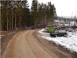 2
2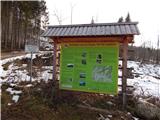 3
3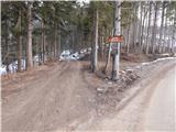 4
4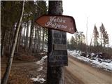 5
5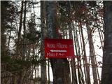 6
6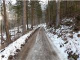 7
7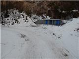 8
8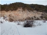 9
9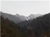 10
10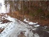 11
11 12
12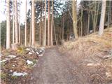 13
13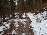 14
14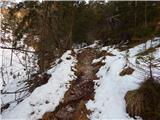 15
15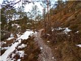 16
16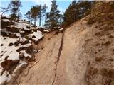 17
17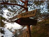 18
18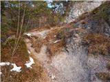 19
19 20
20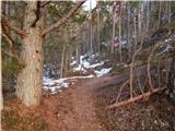 21
21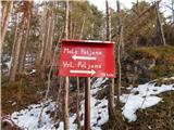 22
22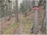 23
23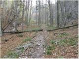 24
24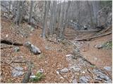 25
25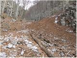 26
26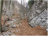 27
27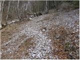 28
28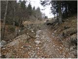 29
29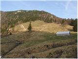 30
30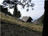 31
31