Pred Belo - Kocbekov dom na Korošici
Starting point: Pred Belo (571 m)
| Latitude/Longitude: | 46,3188°N 14,6005°E |
| |
Walking time: 5 h
Difficulty: partly demanding marked way
Elevation gain: 1237 m
Elevation difference along the route: 1400 m
Map: Kamniške in Savinjske Alpe 1:50.000
Recommended equipment (summer):
Recommended equipment (winter): ice axe, crampons
Views: 21.616
 | 3 people like this post |
Access to starting point:
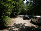
We drive to Kamnik and follow the road ahead towards the valley of Kamniška Bistrica. Approximately 2 km after the lower station of the cable car to Velika Planina, we will notice on the right side of the road a parking lot and mountain signposts for Presedljaj, Konj and Korošica (the parking lot is located after the bridge).
Route description:
From the parking lot, we head onto the path in the direction of Presedljaj, Korošica, Konj and Ojstrica. Already after a few meters the path turns to the right, where at first it ascends barely noticeably, then starts descending and after a few minutes joins a wide cart track. We continue the ascent on a gentle cart track, which soon crosses a torrent, then gently to moderately ascends towards the head of the valley Kamniška Bela.
After a good 30 minutes of walking from the starting point, we arrive at a marked junction, where we continue right on the marked path (left to waterfall Orglice and Korošica via Šraj pesek). The cart track soon after the junction changes into an increasingly steep footpath, which leads us further through dense forest. Higher, the path turns slightly to the left and crosses a torrent gully. A little further, almost unnoticeably to the left branches the path over Najnar štant (demanding and exposed path to Korošica, higher it joins the path over Šraj pesek), and we continue straight on the marked path, which starts ascending in numerous zigzags. Higher for a short time the path ascends more steeply and brings us to a nice viewpoint with a table and bench.
The path ahead slightly descends, crosses a steep slope and brings us to a torrent gully. Here the path turns to the left side of the slope and initially ascends with the help of some pegs and higher steel cables, then returns to the forest, where it steeply ascends for some time. Higher, the path temporarily flattens, then steeply ascends again and in a few minutes of further walking brings us to the saddle Presedljaj, where there is a marked junction.
We continue left in the direction of Korošica (right Konj) on the path which starts ascending on the left side of an indistinct ridge. After a few minutes the path turns to the right and flattens. We continue on a locally quite overgrown footpath, which gently ascends through a belt of dwarf pines. A little further the path crosses an exposed slope above the valley Lučke Bele, where there is also a memorial plaque to a deceased mountaineer. Just a few meters after the memorial plaque, the slope flattens and brings us to an unmarked junction, where to the left branches an unmarked path towards Vršiči and Vežica.
We continue straight on the marked path, which continues towards the north and with some shorter ascents and descents quickly brings us to the place where we join a more trodden path from the valley Lučke Bele. Here we continue left and past the junction of the path to Lučki Dedec walk to Prag (1910 m).
From Prag we continue straight and on a wide footpath, which starts descending transversely towards the green plain Korošica. After 10 minutes of descent the path flattens and to Kocbekov dom only a few steps of easy walking remain.
Pred Belo - Presedljaj 3:00, Presedljaj - Korošica 2:00.

Along the route: Presedljaj (1613m), Prag (1910m)
Photos:
 1
1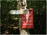 2
2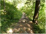 3
3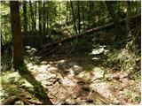 4
4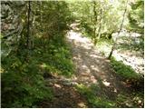 5
5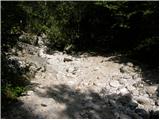 6
6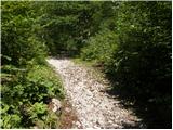 7
7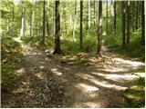 8
8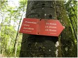 9
9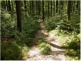 10
10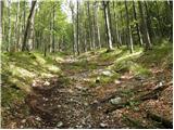 11
11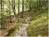 12
12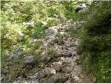 13
13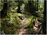 14
14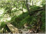 15
15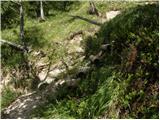 16
16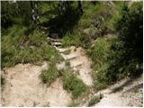 17
17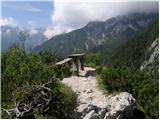 18
18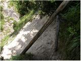 19
19 20
20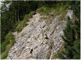 21
21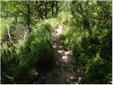 22
22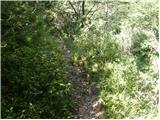 23
23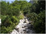 24
24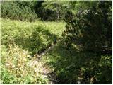 25
25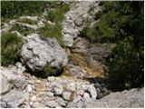 26
26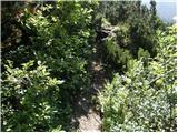 27
27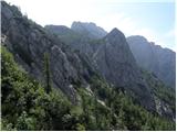 28
28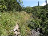 29
29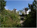 30
30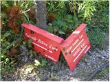 31
31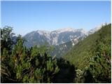 32
32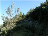 33
33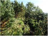 34
34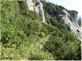 35
35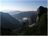 36
36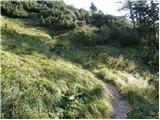 37
37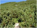 38
38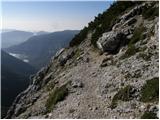 39
39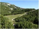 40
40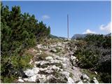 41
41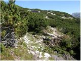 42
42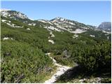 43
43 44
44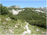 45
45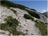 46
46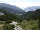 47
47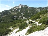 48
48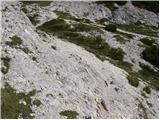 49
49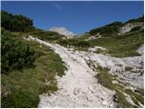 50
50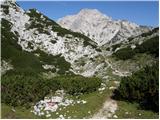 51
51 52
52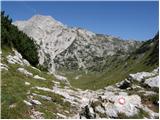 53
53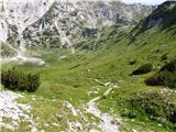 54
54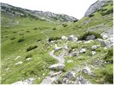 55
55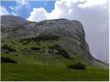 56
56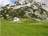 57
57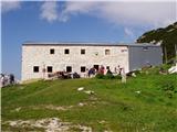 58
58
Discussion about the trip Pred Belo - Kocbekov dom na Korošici
|
| mare120. 08. 2007 |
19.8.07 The path to the hut at Korošica itself is not very demanding but doesn't let you rest even a minute. To Presedljaj arranged and well marked. From there on, watch for junipers along the path, slight slip and cows standing in the middle of the path. The path itself can be done half an hour faster than stated with moderate pace and not too long breaks.
|
|
|
|
| tinkica18. 05. 2011 |
Today we walked the mentioned path. As mare1 wrote.. the path to Presedljaj is excellent, a bit steep a bit level.. mixed.. then the path is unkempt, all bushes (I'm completely scratched everywhere (: ), we didn't encounter cows, but one snake was nicely sunbathing in the middle of the path(: no one has gone this path for a while, so we searched a bit for it, because it's somewhat poorly marked overall (washed-out marks). You orient better by the tall "red poles". But it's true that snow is still present.. so I slid on my butt too (: Ojstrica in about a month, because today it wasn't feasible (: Otherwise the path is quite nice and really takes your breath away (:
|
|
|
|
| Loni13. 08. 2011 |
Since last May, the junipers have been pruned, the cows were dutifully at home in the valley, snakes were basking elsewhere, I didn't miss the markers from Presedljaj to Korošica either. The path seemed sufficiently trodden to me, so there was no dilemma where to go. But I am surprised at myself, in a good two and a half hours I was in front of the hut, after 6 hours back in the valley (with that, I also went to Ojstrica).
|
|
|
|
| trilko14. 01. 2012 |
Today a nice excursion to Presedljaj. The path is nice, about halfway between Prižnica (glacier) and the saddle snow starts - recommended gaiters & crampons, but not necessary.
I went a bit further along the path towards Korošica. The path gets lost a bit further on, I followed the footsteps of the hiker in front of me, so after a couple of 10 meters of elevation I turned back too. Next time 
It was quite windy the whole way. On the way back had to check how much water there is in Orglicah, and the partisan hospital Bela
|
|
|
|
| redbull12. 02. 2012 |
I'm interested in information on what the path to Korošica is like, is there avalanche danger or other dangers from Pred Belo to Korošica. Thanks in advance
Best regards
Dejan
|
|
|
|
| Janez110. 07. 2018 |
Does anyone have information on how it is now with the SPP stamp at Korošica. Are the logbook and stamp perhaps somewhere near this really unfortunate fire site? Thanks!
|
|
|
|
| Kafetarca30. 05. 2022 13:47:55 |
Is this path open again now?
|
|
|
|
| glorija18. 08. 2024 06:41:35 |
The path is very nicely marked and trodden. I also noticed a cairn at the junction that is not on the right path, so stick to the one that is more trodden (up, right). A couple of pegs, rope to Presedljaj, then a bit higher the steepness soon eases and leads along a nicely passable path through scree. Once you walk it, you'll want to do it again. The stamp is in the bivouac, always accessible. Friendly Mr. Filip will serve you
with cold drinks... I needed less walking time than stated. Mountain greetings!
|
|
|
To post a comment you must log in:
If you do not yet have a username, you must first
register.