Rifugio Ra Stua - Croda del Beco / Seekofel
Starting point: Rifugio Ra Stua (1668 m)
Starting point Lat/Lon: 46.62501°N 12.09918°E 
Time of walking: 3 h 35 min
Difficulty: difficult marked way
Difficulty of skiing: no data
Altitude difference: 1142 m
Altitude difference (by path): 1150 m
Map: Tabacco 03 1:25.000
Access to starting point:
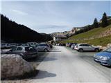
Over the border crossing Rateče we drive to Trbiž / Tarvisio, where we head onto the motorway in the direction of Vidma / Udine. We leave the motorway at the exit for Tolmezzo and follow the road to the mentioned settlement. From Tolmezzo we continue in the direction of the settlement Ampezzo and mountain pass Passo della Mauria. The road then starts descending and brings us into the Cadore valley, where we continue right (left Belluno and Cortina d'Ampezzo) in the direction of the settlement Auronzo. After a few more km of driving we come to the next larger junction, where we turn right in the direction of the settlement Misurina (left pass Tre Croci). From here we descend along the road to a larger junction where we continue left towards Cortina d'Ampezzo (right Austria). From the mentioned junction we continue for approximately 10 km towards Cortina d'Ampezzo, then in a sharp left turn we turn right onto the road towards the mountain hut Rifugio Ra Stua. We follow the narrow asphalted road all the way to the larger parking lot at the mountain hut.
Path description:
From the mountain hut Rifugio Ra Stua we continue on a macadam road which is closed to traffic. Already immediately at the beginning a footpath towards the notch Forcella Lerosa and valley Gotres branches off to the right. A little later the path towards the valley Valbones and towards the bivouac Helbig Dall'Oglio also branches off to the right.
We continue on the gently sloping macadam road which for some time still runs along pastures, then brings us into the forest. Further we walk for some time through the forest along the stream Boite, then we come again onto grassy slopes where there is also a junction.
To the left the road towards the mountain hut Rifugio Fodara Vedla branches off, we continue straight on the macadam road towards the mountain hut Rifugio Sennes. Already after a few dozen meters we come to another junction.
This time we head right onto the footpath towards the lake Lago di Foses and mountain hut Rifugio Biella, further along the road the path leads towards the mountain hut Rifugio Sennes. From the junction the path first leads us across grassy slopes on which a footpath from the mountain hut Ra Stua joins us from the right. The path then brings us into dwarf pines through which we begin to ascend more steeply. Through the dwarf pines we quickly gain altitude and soon views open up towards the mountain group Tofana and towards Monte Pelmo. Later the path turns slightly to the left and brings us to slightly gentler slopes. From the dwarf pines the path brings us to more grassy terrain where a somewhat less trodden path joins us from the right, running below the slopes of the peak Monte Geralbes. The increasingly scenic path here runs towards the northwest and leads us past the smaller lake Lago di Remeda Rossa. The path then descends slightly and a view also opens up towards the summit Croda del Becco (Seekofel). The path then leads past the lake Lago Piccolo and brings us to the larger lake Lago di Fosses.
At the lake where there is a junction we continue right following the signs »Rifugio Biella«. The path first leads us along the left side of the lake and then begins to ascend gently again. When the path turns left we come to a somewhat less visible junction. Here an unmarked path branches off to the right towards the notch Forcella Cocodain, we continue left on the marked path towards the mountain hut Rifugio Biella.
The path further runs towards the northwest towards the slopes of the peak Croda del Becco and gently ascends the whole time on a mostly grassy slope. Such a path then continues all the way to the mountain hut Rifugio Biella.
At the hut we continue slightly left following the signs »Croda del Beco«. After a short ascent the path quickly brings us to the notch Forcella Sora Forno where there is a junction.
At the junction where there is also a small chapel we continue left towards the summit Croda del Beco. Here the path begins to ascend steeply along a rocky ridge. Higher up, on a short section, some fixed protections in the form of a chain also assist us. Further on the slope becomes less steep and the path runs along the left side of the ridge. The path ascends diagonally for some time and then we soon reach the summit from which there is a magnificent view in all directions.
Pictures:
 1
1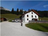 2
2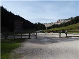 3
3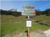 4
4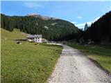 5
5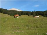 6
6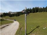 7
7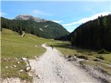 8
8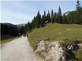 9
9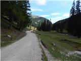 10
10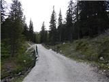 11
11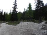 12
12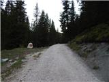 13
13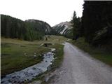 14
14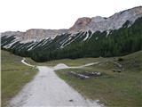 15
15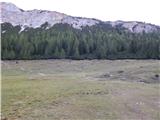 16
16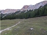 17
17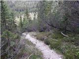 18
18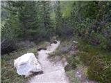 19
19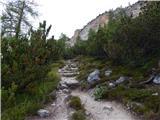 20
20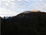 21
21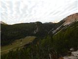 22
22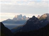 23
23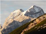 24
24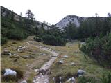 25
25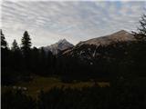 26
26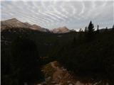 27
27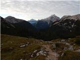 28
28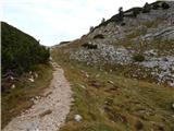 29
29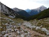 30
30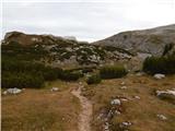 31
31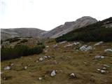 32
32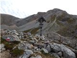 33
33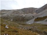 34
34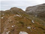 35
35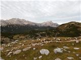 36
36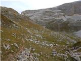 37
37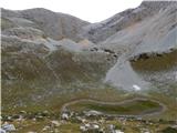 38
38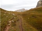 39
39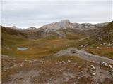 40
40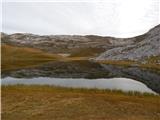 41
41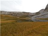 42
42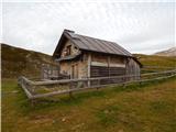 43
43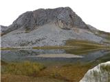 44
44 45
45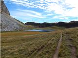 46
46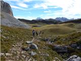 47
47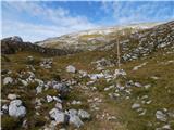 48
48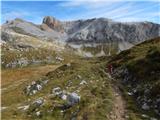 49
49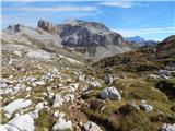 50
50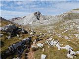 51
51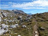 52
52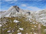 53
53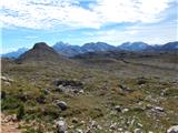 54
54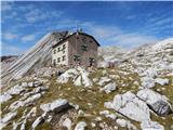 55
55 56
56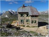 57
57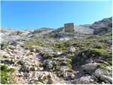 58
58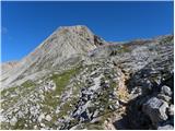 59
59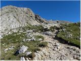 60
60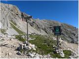 61
61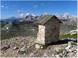 62
62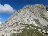 63
63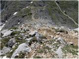 64
64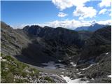 65
65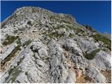 66
66 67
67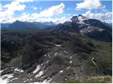 68
68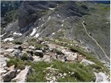 69
69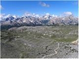 70
70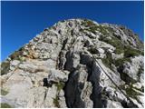 71
71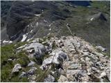 72
72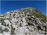 73
73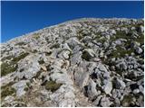 74
74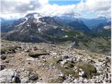 75
75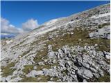 76
76 77
77 78
78 79
79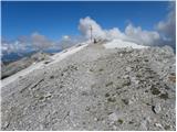 80
80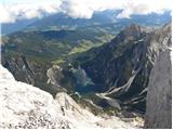 81
81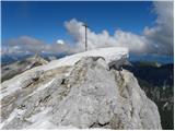 82
82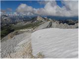 83
83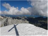 84
84