Selski most - Sveti Štefan (Kupljenik)
Starting point: Selski most (427 m)
Starting point Lat/Lon: 46.3459°N 14.1026°E 
Time of walking: 1 h 5 min
Difficulty: easy marked way
Difficulty of skiing: no data
Altitude difference: 215 m
Altitude difference (by path): 230 m
Map: Karavanke - osrednji del - 1:50.000
Access to starting point:
A) From the highway Ljubljana - Jesenice, we take the exit Lesce, and then continue driving towards Bled. In Bled, we "ignore" the left turn-offs towards Koritno, Bodešče, Ribno and Selo and continue driving to the traffic light, where the road branches off to the right towards Gorje and Pokljuka. At the mentioned crossroad, we continue straight and begin descending towards Lake Bled. When we notice the Chinese restaurant Peking on the left, we leave the main road towards Bohinjska Bistrica and, behind the restaurant, continue left onto Ulica Narodnih herojev. At a few smaller crossroads, we continue on the main road, then we arrive at Cankarjeva cesta, along which we drive for some time, or until the crossroad by the chapel, where we continue slightly right towards Selo and Dobra gora (still on the main road Ribno). We continue driving on a gradually narrower road, which leads us for some time along meadows and fields, then it enters the forest through which it begins to descend. Lower down, the forest ends, and we arrive in the village Selo and a little further at a smaller crossroad, where we continue straight (left and then immediately right) downhill towards Sava and Kupljenik (left Ribno, right Bled). There follows some more descent on the still relatively narrow road, then the asphalt ends, and we drive on a somewhat wider macadam road to Selski most bridge over the Sava Bohinjka river. We park in a suitable place by the bridge.
B) First, we drive to Podbrdo and from there to Bohinjska Bistrica (by car-train shuttle or via Soriška planina). From Bohinjska Bistrica, we continue driving towards Bled, and there, when we arrive at the lake, we turn right towards Selo. Further on, we drive along the narrow Mlinska cesta. Bled soon ends, and the still relatively narrow road brings us to the village Selo, where at a smaller crossroad in the middle of the village we continue right towards Sava and Kupljenik (left Bled, straight Ribno). There follows some more descent on the still relatively narrow road, then the asphalt ends, and we drive on a somewhat wider macadam road to Selski most bridge over the Sava Bohinjka river. We park in a suitable place by the bridge.
Path description:
From the starting point, we head over the bridge across Sava Bohinjka, from which a nice view opens onto Ribenska gora, and after the bridge we continue right towards Bohinjska Bela, Kupljenik and Talež. For a short time we continue on the macadam road, then we arrive at a smaller crossroad, where to the left a road initially still branches off towards Talež, and we continue straight towards Kupljenik. We continue further on the road, then at the next unmarked crossroad we continue slightly left, so that we walk along the right edge of the nearby fence. Further on, the still gentle road turns into a cart track, which at the junctions we follow towards Kupljenik. A few minutes further, when the path moves onto the slopes of Hom (675 m), it begins to ascend more steeply to the right, leading us across fairly steep slopes. Higher up, the forest temporarily ends and the path brings us to a nice viewpoint at the chapel Na Koren, where we can briefly pause and enjoy the beautiful views.
The path ahead temporarily returns to the forest, then leads us along the edge of meadows. Somewhat behind the NOB memorial, which we notice on the left side, the path turns somewhat more to the left and begins to ascend towards the settlement Kupljenik with views of Babji zob. We reach the asphalt road, which leads through Kupljenik, a few steps above the small chapel, and follow it left towards Jama. The path ahead leads past a relatively new cross, then the road slowly begins to turn increasingly to the right. At the smaller crossroad, located between individual houses, we continue right (left Talež), then continue along the gentle asphalt road, from which beautiful views open towards the Karawanks and Lake Bled. Past another NOB memorial and past the fire station, we soon arrive at the place where we continue left towards the cave, on the path along which in one minute of further walking we arrive at the church of St. Stephen.
Description and pictures refer to the condition in 2015 (April).
Pictures:
 1
1 2
2 3
3 4
4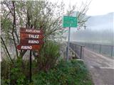 5
5 6
6 7
7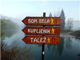 8
8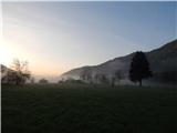 9
9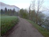 10
10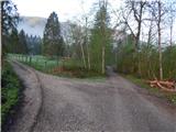 11
11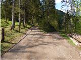 12
12 13
13 14
14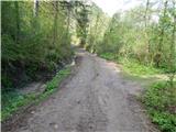 15
15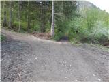 16
16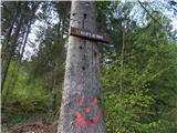 17
17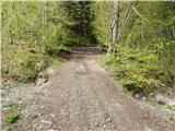 18
18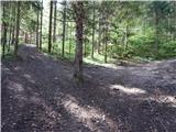 19
19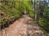 20
20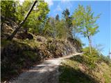 21
21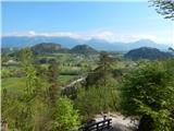 22
22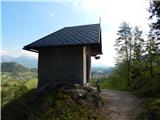 23
23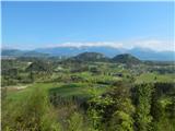 24
24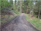 25
25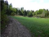 26
26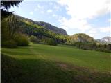 27
27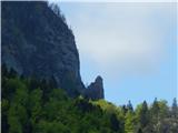 28
28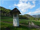 29
29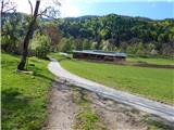 30
30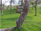 31
31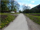 32
32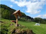 33
33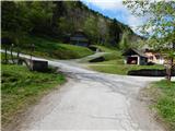 34
34 35
35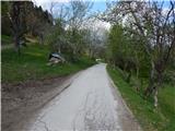 36
36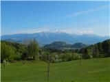 37
37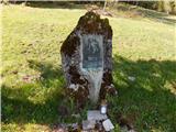 38
38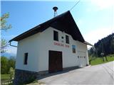 39
39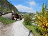 40
40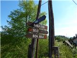 41
41 42
42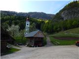 43
43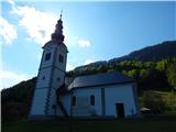 44
44