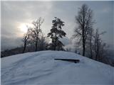
Sora - Osolnik (on footpath)
Starting point: Sora (360 m)
Starting point Lat/Lon: 46.1414°N 14.3703°E 
Path name: on footpath
Time of walking: 1 h 35 min
Difficulty: easy marked way
Difficulty of skiing: no data
Altitude difference: 498 m
Altitude difference (by path): 510 m
Map: Ljubljana - okolica 1:50.000
Access to starting point:
A) First, we drive to Medvode, after that at Spar store we leave the main road and we continue towards the railway station and settlement Sora. In Sora at first road towards Katarina branches off to the left, and a little ahead also towards Osolnik. We drive on the road towards Osolnik and then after a shorter ascent, we park on a parking lot below the church of St Štefan. We can also park a little lower on a parking lot by the presbytery.
B) From Kranj we drive towards Škofja Loka, from periphery of Škofja Loka then we follow the signs for Gorenja vas. Before the tunnel Sten from a roundabout we drive on exit in the direction of the settlement Sora. Further, we drive through the settlement Hosta, Pungert, Gosteče and Draga, to the settlement Sora, where we turn right towards Osolnik and then after a shorter ascent, we park on a parking lot below the church of St Štefan. We can also park a little lower on a parking lot by the presbytery.
C) From the valley Poljanska dolina we drive towards Škofja Loka and then on bypass road and through the tunnel Sten. After the tunnel we turn right and we follow the signs for settlement Sora. Further, we drive through the settlement Hosta, Pungert, Gosteče and Draga, to the settlement Sora, where we turn right towards Osolnik and then after a shorter ascent, we park on a parking lot below the church of St Štefan. We can also park a little lower on a parking lot by the presbytery.
Path description:
At the beginning of the parking lot marked footpath branches off to the left, which starts ascending through the forest. After few minutes, we cross an asphalt road which leads towards Osolnik (to here possible also on the road, if we parked on the upper part of the parking lot), and we continue on a marked path. We continue the ascent through the forest, at few smaller crossings we follow the blazes. Higher, the path reaches side ridge, where it flattens and gets very close to an asphalt road. We continue a little right from the road, and the path quickly splits.
We continue slightly left (right Hom 15 minutes) and further we are ascending diagonally on mostly southern slopes of Hom. When a little further we reach indistinct small ridge, from the right joins the path from the peak Hom, and we continue left and a little further we reach an asphalt road. The path continues on the road, and occasionally on a marked footpath which runs right or left from the road. Further a quite gently sloping path then brings us to a crossing, where from the left joins a marked path from Ločnice, and we continue straight to a nearby crossroad and a crossing.
At the crossing, at the religious symbol we finally leave the road and we continue the ascent on a gradually steeper mountain path. A little further from the right joins also unmarked, but well visited path from Gosteče.
Next follows few minutes of a steep ascent on a marked path and we reach the church of St. Mohor and Fortunat on Osolnik, for a nice view it is worth to walk a little further.
Description and pictures refer to a condition in the year 2018 (February).
Pictures:
 1
1 2
2 3
3 4
4 5
5 6
6 7
7 8
8 9
9 10
10 11
11 12
12 13
13 14
14 15
15 16
16 17
17 18
18 19
19 20
20 21
21 22
22 23
23 24
24 25
25 26
26 27
27 28
28 29
29 30
30 31
31 32
32 33
33 34
34 35
35