Starting point: Spodnja Kokra (530 m)
| Latitude/Longitude: | 46,3027°N 14,4754°E |
| |
Walking time: 5 h 45 min
Difficulty: difficult marked way
Elevation gain: 1602 m
Elevation difference along the route: 1690 m
Map: Karavanke - osrednji del 1:50.000
Recommended equipment (summer):
Recommended equipment (winter): ice axe, crampons
Views: 2.907
 | 1 person like this post |
Access to starting point:
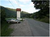
From the Ljubljana-Jesenice highway, take the Kranj-East exit and follow the road ahead in the direction of Jezersko. A few kilometers after the turn-off for Preddvor, we will notice a transformer on the right side of the road and a parking lot by it, where we park. Here there are also signposts for the mountain hut Dom Čemšenik.
Route description:
From the parking lot first carefully cross the road, then head to the footpath in the direction of the mountain hut Dom Čemšenik. The wide path barely noticeably ascends to the homestead Polajnar, where we step onto the road, which we follow to the right.
The road steeply ascends right after the house, but loses the asphalt surface a little higher. Further the road flattens and turns slightly to the left, where it comes very close to the Čemšeniški potok stream. A little further we cross the mentioned stream and immediately after it we arrive at a marked junction, where we continue on the left road in the direction of the mountain hut Dom Čemšenik. The road then starts to ascend more steeply again and after less than 30 minutes of further walking brings us to the mountain hut Dom Čemšenik.
From the mountain hut Dom Čemšenik continue in the direction of Javorov vrh (on the sign Javorjev vrh) along the path that enters the forest after a few meters. The initially moderately steep path soon brings us to a torrent gully, along which we then ascend for some time. Higher the path turns right and ascends even more steeply. We follow this relatively steep path, which runs through dense forest the whole time, all the way to the junction on the saddle between Potoška gora on the left and Javorov vrh on the right.
Continue right (left Potoška gora and Sveti Jakob) on a moderately steep path that after a short ascent brings us to the southwestern ridge of Javorov vrh, from which some views open towards Cjanovca. The path goes only a little further again into the dense forest, where we reach the next well-marked junction.
Here continue left in the direction of Srednji vrh, Kališče and Storžič (straight Javorov vrh 15 minutes) on the path that after a few more steps brings us to a pleasant spring. Follows a half-hour crossing of the slopes below Javorov vrh, which ends on the saddle between the mentioned peak and Cjanovca.
On the saddle the path from Javorov vrh joins us, and we continue left in the direction of Hudičev boršt (straight Cjanovca and Srednji vrh). The path further crosses slopes to the west, then brings us out of the forest onto the panoramic southern slopes of Cjanovca. Follows the crossing of occasionally steeper grassy slopes, which end at the edge of the forest Hudičev boršt. From here the path ascends somewhat more steeply and after a few minutes of further walking brings us to the shelter Zavetišče v Hudičevem borštu.
From the shelter continue towards the west, where we quickly reach the spring in Hudičev boršt, immediately after it to a marked junction, where we continue straight (left downhill Mačenska pot to Mače). Follows a shorter crossing of a grassy slope, then the path enters the forest and brings us to a junction, where to the right branches the path to Dolga njiva, Cjanovci, Srednji vrh and Mali Grintovec, and we continue straight. The path ahead crosses slopes to the left for a short time, then after crossing a gully brings us to a junction, where we continue right towards Kališče (lower path leads to Mače).
The path ahead still crosses slopes to the left. During the crossing we will come to a smaller scree, from which the first view towards the valley opens. Follows another short crossing and the path brings us into the valley of Suha, where from the left also joins an unmarked path from Mače.
Continue in the direction of Kališče and continue the ascent on a gradually steeper path. The path ahead ascends through dense forest for some time, then brings us to the foot of rocky cliffs and only a little higher to the ridge, where a few meters from the path we notice a small hut. Here the path turns right and steeply ascends over a shorter rocky step. The path flattens here and a few meters further joins the usual path leading to Kališče.
Continue in the direction of Kališče and continue the ascent on a moderately steep path, along which in 5 minutes of further walking we arrive at the Planinski dom na Kališču.
Behind the Dom na Kališču we notice a mountaineering direction sign with numerous continuation options. We continue along the gentle and panoramic ridge path in the direction of Storžič, Bašeljski vrh..., which continues towards the north. After a few minutes of easy walking with beautiful views reaching to the Julian Alps, we arrive at a junction, where to the left branches the path towards the church sv. Lovrenc nad Bašljem, planina Javornik and Kriška gora, to the right branches the path to Bašeljski vrh and Mali Grintovec, and we continue straight in the direction of Storžič. Follows a few-minute crossing of mostly the western slopes of Bašeljski vrh, then we arrive at the grassy Bašeljski preval, where from the right joins the path from Jezersko (in descriptions starting point Jekarica).
Again continue straight in the direction of Storžič, this time on a path that begins to ascend steeply through a belt of dwarf pines. After approximately 30 minutes of ascent from the saddle we step onto the ridge of Storžič, which we soon leave as the path passes to the southern slopes of the mountain. Over quite steep southern slopes we ascend on a steep path, which is dangerous for slipping in several places, especially when wet. Higher the path flattens somewhat and returns to the ridge, along and beside which it then continues. To the increasingly panoramic path a little below the summit from the left also join paths from sv. Lovrenc, planina Javornik and the path over Psica and through Žrelo. Here continue slightly right and in a few steps reach one of the most visited two-thousanders in Slovenia.
Spodnja Kokra - Dom Čemšenik 50 minutes, Dom Čemšenik - Hudičev boršt 2:05, Hudičev boršt - Kališče 1:20, Kališče - Storžič 1:30.

Photos:
 1
1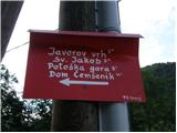 2
2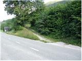 3
3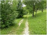 4
4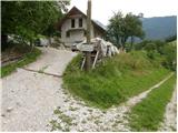 5
5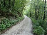 6
6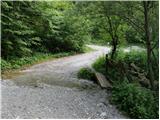 7
7 8
8 9
9 10
10 11
11 12
12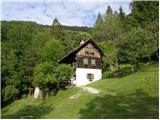 13
13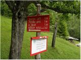 14
14 15
15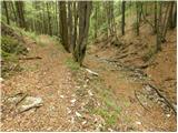 16
16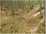 17
17 18
18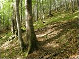 19
19 20
20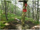 21
21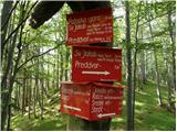 22
22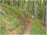 23
23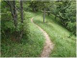 24
24 25
25 26
26 27
27 28
28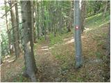 29
29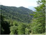 30
30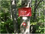 31
31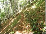 32
32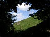 33
33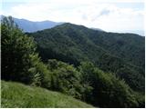 34
34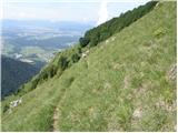 35
35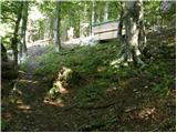 36
36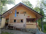 37
37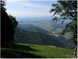 38
38 39
39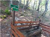 40
40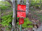 41
41 42
42 43
43 44
44 45
45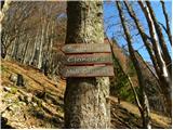 46
46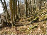 47
47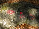 48
48 49
49 50
50 51
51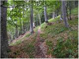 52
52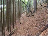 53
53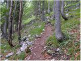 54
54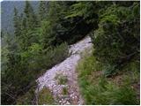 55
55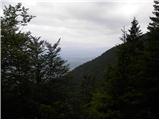 56
56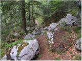 57
57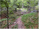 58
58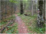 59
59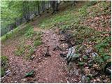 60
60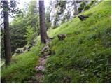 61
61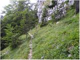 62
62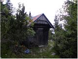 63
63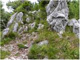 64
64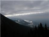 65
65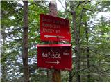 66
66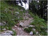 67
67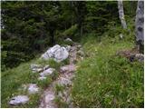 68
68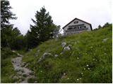 69
69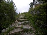 70
70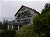 71
71 72
72 73
73 74
74 75
75 76
76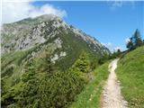 77
77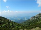 78
78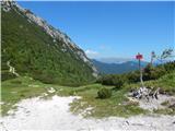 79
79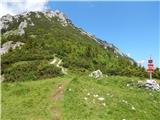 80
80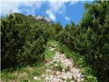 81
81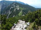 82
82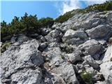 83
83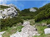 84
84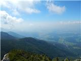 85
85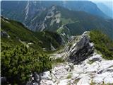 86
86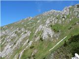 87
87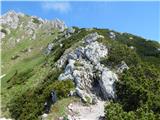 88
88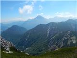 89
89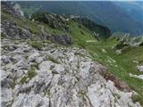 90
90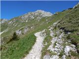 91
91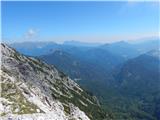 92
92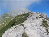 93
93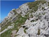 94
94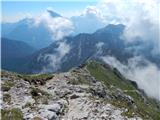 95
95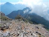 96
96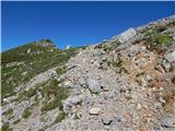 97
97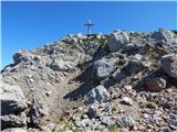 98
98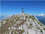 99
99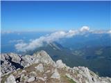 100
100 101
101
Discussion about the trip Spodnja Kokra - Storžič
To post a comment you must log in:
If you do not yet have a username, you must first
register.