Šujica (Na Gmajni) - Toško Čelo
Starting point: Šujica (Na Gmajni) (316 m)
Starting point Lat/Lon: 46.0663°N 14.4125°E 
Time of walking: 50 min
Difficulty: easy unmarked way
Difficulty of skiing: no data
Altitude difference: 274 m
Altitude difference (by path): 274 m
Map: Ljubljana - okolica 1:50.000
Access to starting point:
A) We drive to Dobrova (to here from Ljubljana, Brezovica pri Ljubljani or Podutik over the mountain pass Preval), and then we continue driving in the direction of Polhov Gradec. At the sign for the end of the settlement Šujica we turn right, and after few 10 meters we get to the triangular crossroad, where the described path begins. We can park higher by the described path or on an appropriate place in Šujica, by the beginning of the described path there aren't any parking spots.
B) From Polhov Gradec we drive towards Ljubljana, and then at the sign, which marks the beginning of the settlement Šujica we turn left, and after few 10 meters we get to the triangular crossroad, where the described path begins. We can park higher by the described path or on an appropriate place in Šujica, by the beginning of the described path there aren't any parking spots.
Path description:
From the triangular crossroad we go left to the near chapel, and before the chapel we go on the right road which continues towards the north. The road at first leads past few more houses, and after the meadow passes into the forest. Here from the road a cart track branches off to the right, on which we continue. A little further, the cart track splits, and we continue on the slightly right (possible also on the slightly left), which out of the forest brings us on a meadow, through which we ascend on a beaten path. When the path returns into the forest both paths join, and at the next crossings we stick to a better beaten path (usually slightly right). Further, the path becomes steeper, and higher it brings us on a driving road, where the path leads us past few houses. Here the steepness decreases and on a macadam road we ascend to the juncture with the main road Toško Čelo - Katarina, which we reach below the inn Pri Bitencu.
Here we go right (left Katarina and hunting cottage on Toško Čelo on the road) and we for some time continue on the asphalt road which is with nice views slowly descending.
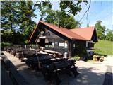
Before the road starts considerably descending, we continue slightly left, on a cart track which ascends diagonally above the asphalt road. On the cart track, we walk past a concrete trough, a little and behind it at two successive crossings we go left. A little further, we step out of the forest and the path brings us to the hunting cottage on Toško Čelo.
Description and pictures refer to a condition in the year 2017 (May).
Pictures:
 1
1 2
2 3
3 4
4 5
5 6
6 7
7 8
8 9
9 10
10 11
11 12
12 13
13 14
14 15
15 16
16 17
17 18
18 19
19 20
20 21
21 22
22 23
23 24
24 25
25 26
26 27
27 28
28 29
29 30
30 31
31 32
32