Tallach - Kahlkogel/Golica (via Quadiaalm)
Starting point: Tallach (540 m)
Starting point Lat/Lon: 46.5324°N 14.0649°E 
Path name: via Quadiaalm
Time of walking: 3 h 50 min
Difficulty: partly demanding marked way
Difficulty of skiing: no data
Altitude difference: 1295 m
Altitude difference (by path): 1320 m
Map: Karavanke 1:50.000 - osrednji del
Access to starting point:
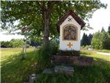
A) Through the Karawanks Tunnel, we drive into Austria, then leave the motorway at the first exit. When we reach the main road, we go left towards the settlement Šentjakob v Rožu / St. Jakob im Rosental. We continue driving along Rosentalstraße, and after the settlement Šentjakob v Rožu we also cross the stream Rosenbach. A little after the bridge, we leave the main road and continue driving right into the settlement Tale / Tallach. Driving through the settlement follows, and when we reach another road at Pension Lindenhof, we cross it, then park on the parking lot behind the chapel.
B) Over the Ljubelj border crossing, we drive into Austria and follow the main road towards Celovec / Klagenfurt. When we arrive in the valley, at the second roundabout, which is still on the right bank of the river Drau, we turn onto the exit Bistrica v Rožu / Feistritz im Rosental, then drive along the main road to the settlement Podgorje / Maria Elend. After the mentioned settlement, we turn left towards Podrožca / Rosenbach. The road then brings us to the settlement Tale / Tallach, where before Pension Lindenhof we turn left and park on the parking lot by the chapel.
Path description:
From the starting point, we continue in the direction of the mountain pasture Kladje / Quadiaalm, Golica / Kahlkogel and chapel Maria Elend / Bergkapellen Maria Elend. The road, which is closed to public traffic, soon leads us through the underpass under the railway track, then we arrive at the first junction, where we continue right in the direction of Golica (straight to chapel). A fairly winding road, along which we notice a sign that we are entering the bear area, then over the bridge it crosses Radischgraben, after a few more minutes of walking we arrive at the next junction, where we go left (straight to Podrožca / Rosenbach). From the junction we walk a few more minutes along the road, then higher at the left bend we leave it, as the signs for path 675 direct us slightly right onto a cart track. We ascend the cart track, which ends quickly, and continue the ascent across an overgrown meadow. Higher we reach another cart track, which leads us for a short time through the overgrown section, then the path enters the forest and continues traversing to the right. After a short traverse, we reach another cart track, from it we go a few steps higher to the right. A short traverse follows, then we join the path from Podrožca.
We continue in the direction of Golica and the nearby spring, to which we arrive after about 5 minutes of further walking.
From the spring, where a sign and a bench are located, we continue along the path, which first leads us through a small valley, from which the path soon turns sharply left and ascends steeply traversing. A few minutes of ascent through the forest follow, then the path quickly widens into a macadam road, along which we ascend briefly. Higher we leave the road, then a bit further we cross it again, after that we stay on it. When a little further the forest thins, a nice view towards Golica opens up, a little further we cross a pasture fence. From crossing the fence, a few more minutes of walking along the road follow and we reach the mountain pasture Kladje.
From the mountain pasture we continue along the road, which forks a bit further. We continue along the right road (left hunting hut and mountain pasture Zgornje Kladje), along which in a few minutes we reach the saddle Kladje, where we leave the road and continue left to the nearby mountain signposts.
We continue in the direction of Golica and follow the path along the forested ridge, which is initially fairly gentle, higher narrower and steeper. Somewhat further from the salt lick the ridge becomes quite narrow, and the path especially when wet on a short section is dangerous for slipping. After this section the path leaves the ridge and turns slightly left, where it traverses the slopes to the left. We continue traversing the landslide slope, where due to the torn cable additional caution is needed (June 2017). After the landslide we walk a few dozen steps along steep slopes, then the slope becomes somewhat less steep. Further the forest begins to thin, and the path becomes steeper. When with nice views we reach the ridge, the path becomes even steeper, so that it ascends very steeply. For some time we ascend through dwarf pines, then when the dwarf pines end, we quickly reach the border ridge, where we continue left.
A few minutes of moderate ascent along the panoramic ridge follow and the path takes us to the summit of Golica.
Tale - Planina Kladje 2:15, Planina Kladje - saddle Kladje 10 minutes, saddle Kladje - Golica 1:25.
Description and pictures refer to the condition in 2017 (June).
On the way: Hladna voda / Kaltwasser (915m),
Quadiaalm (1271m), Sedlo Kladje / Quadia Sattel (1300m)
Pictures:
 1
1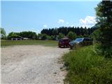 2
2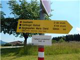 3
3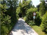 4
4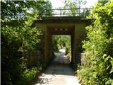 5
5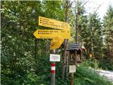 6
6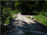 7
7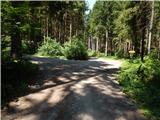 8
8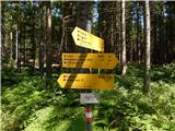 9
9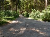 10
10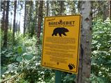 11
11 12
12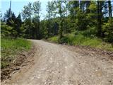 13
13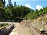 14
14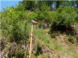 15
15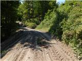 16
16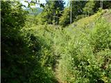 17
17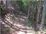 18
18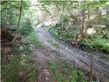 19
19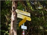 20
20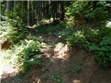 21
21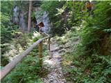 22
22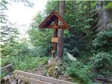 23
23 24
24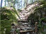 25
25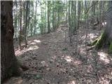 26
26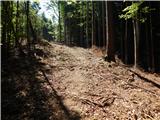 27
27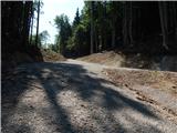 28
28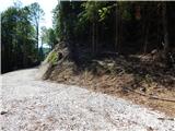 29
29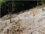 30
30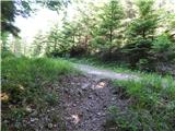 31
31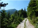 32
32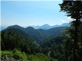 33
33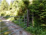 34
34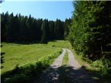 35
35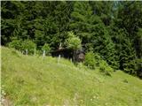 36
36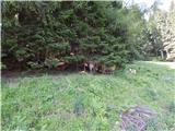 37
37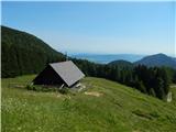 38
38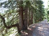 39
39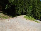 40
40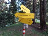 41
41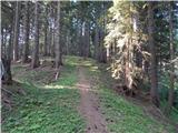 42
42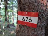 43
43 44
44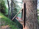 45
45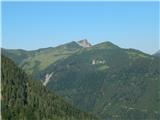 46
46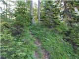 47
47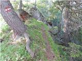 48
48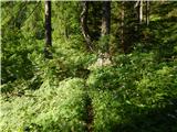 49
49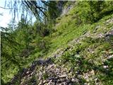 50
50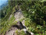 51
51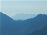 52
52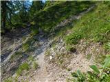 53
53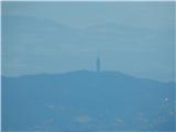 54
54 55
55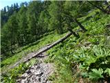 56
56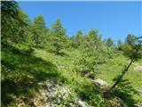 57
57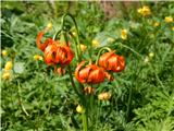 58
58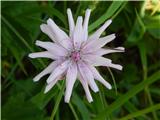 59
59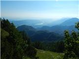 60
60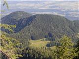 61
61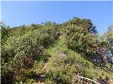 62
62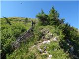 63
63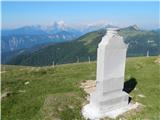 64
64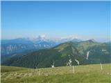 65
65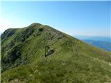 66
66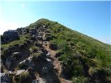 67
67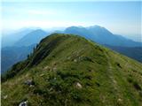 68
68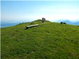 69
69 70
70