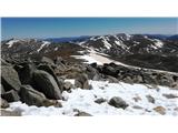
Thredbo - Mount Kosciuszko (Merritts Track & Mt. Kosciuszko Track)
Starting point: Thredbo (1370 m)
Starting point Lat/Lon: -36.50391°N 148.30441°E 
Path name: Merritts Track & Mt. Kosciuszko Track
Time of walking: 4 h
Difficulty: easy marked way
Difficulty of skiing: easily
Altitude difference: 858 m
Altitude difference (by path): 950 m
Map:
Access to starting point:
The starting point is Thredbo, New South Wales in Australia. Park in the designated areas if arriving by car. Thredbo is situated in the Kosciuszko national park, therefore park entrance fees apply.
In the summertime, no public transport is available. Last town with public transport in Jindabyne 35 km from Thredbo. The only option is to take a school-bus (once a day at around 16:00, mind weekends and school holidays).
Path description:
The Merritts Track begins in Thredbo just next to the Valley Terminal (to the right of the Kosciuszko express building), circles tennis courts, shortly after a bobsled and then a small footbridge over Merritts creek. Upon reaching the ski runs (Bunny Walk and Village Trail) carefully follow the Merritts Track signs. The Track joins the ski run again, but forks to the right soon after. Follow a marked footpath to the Picnic Lookout site. From here continue through a snow gum forest by ascending several flights of stairs. Carefully cross a mountain bike track and immediately follow the track again into the forest and over several steps. Later, cross the ski run and follow the track to the Lower and few minutes later to the Upper Bench Seat. Afterward, pass the Black Sallees Mountain Bar & Bistro where the Track reaches the forest line, turn left and immediately right to the highest Track. Follow it for 20 meters and turn right to the Merritts Track. Follow the Track to the Eagles Nest or the Top of Kosciuszko Express chairlift.
Mt. Kosciuszko Track starts immediately at the top of the Kosciuszko Express Chairlift. After half a kilometer, Mt. Kosciuszko Track reaches a bridge over the Merritts Creek. At this point, the metal walkway begins. It leads first by the Mt. Kosciuszko Lookout, soon after it passes the headwaters of Snowy River where it ascends to the Lake Cootapatamba Lookout. It is less than a kilometer to Rawson Pass (another track also joins here from Charlotte Pass). From Rawson Pass a wide dusty track continues up to the Mount Kosciuszko. It circles the mountain before reaching the top. A beautiful view can be enjoyed at the top. Also to the second-highest mountain in the (mainland) Australia, i.e. Mount Townsend, 2209m.
On the way: Black Sallees Mountain Bar & Bistro (1840m), Eagles Nest (1927m), Merritts Creek (1955m), Mt. Kosciuszko Lookout (2040m), Snowy River (2035m), Lake Cootapatamba (2047m), Rawson Pass (2100m)
Pictures:
 1
1 2
2 3
3 4
4 5
5 6
6 7
7 8
8 9
9 10
10 11
11 12
12 13
13 14
14 15
15 16
16 17
17 18
18 19
19 20
20 21
21 22
22 23
23 24
24 25
25 26
26 27
27 28
28 29
29 30
30 31
31 32
32 33
33 34
34 35
35 36
36 37
37 38
38 39
39 40
40 41
41 42
42 43
43 44
44 45
45 46
46 47
47 48
48 49
49 50
50 51
51 52
52 53
53 54
54 55
55 56
56 57
57 58
58 59
59 60
60 61
61 62
62 63
63 64
64 65
65 66
66 67
67 68
68 69
69 70
70 71
71 72
72 73
73 74
74 75
75 76
76 77
77 78
78 79
79 80
80 81
81 82
82 83
83 84
84 85
85 86
86 87
87 88
88 89
89 90
90 91
91 92
92 93
93 94
94 95
95 96
96 97
97 98
98 99
99 100
100 101
101 102
102 103
103 104
104 105
105 106
106 107
107 108
108 109
109 110
110 111
111 112
112 113
113 114
114 115
115 116
116 117
117 118
118 119
119 120
120 121
121 122
122 123
123 124
124 125
125 126
126 127
127 128
128 129
129 130
130 131
131 132
132 133
133 134
134 135
135 136
136 137
137 138
138 139
139 140
140 141
141 142
142 143
143 144
144 145
145 146
146 147
147 148
148 149
149 150
150 151
151 152
152 153
153 154
154 155
155 156
156 157
157 158
158