Tinčkova koča - Begunjščica
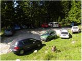
Starting point: Tinčkova koča (1070 m)
Starting point Lat/Lon: 46.4228°N 14.1991°E 
Time of walking: 3 h 15 min
Difficulty: partly demanding marked way
Difficulty of skiing: very demanding
Altitude difference: 990 m
Altitude difference (by path): 990 m
Map: Karavanke - osrednji del 1:50.000
Access to starting point:
From the highway Ljubljana - Jesenice we go to the exit Lesce and follow the road ahead in the direction of Žirovnica and Jesenice. After a few km of driving, we will get to a crossroads, where the road to Žirovnica and Moste branches off to the right (from the direction of Jesenice left). Only a few meters ahead in the next crossroads, we turn left to Moste (right Žirovnica). Further, we drive past a monument to fallen soldiers, where the road starts ascending a hill below the railway track. On top of the slope, we turn right (at the sign Vila Karin), and we drive towards Završniško jezero lake and Valvasorjev dom. The road then flattens and brings us to a crossroads, where the road towards the mountain hut Valvasorjev dom branches off to the left, and we continue straight on the initially still asphalted road. The road soon becomes macadam, and we follow it to a parking lot near the mountain hut Tinčkova koča. The road in the upper part is often in quite bad condition.
Path description:
From the parking lot at the mountain hut Tinčkova koča we continue on a wide rocky cart track in the direction of the mountain hut Koča pri izviru Završnice. Already after a few steps of walking blazes point us slightly right, on a somewhat steeper footpath which ascends over a panoramic grassy slope, and then it returns to the aforementioned cart track which we follow to the right. Cart track, which relatively steeply ascends through the forest, after a few minutes of further walking brings us to a grazing fence, behind which we come to the marked junction.
We continue right in the direction of the mountain hut Roblekov dom (straight mountain hut Koča pri izviru Završnice) on the path which further at first gently, and then steeper and steeper ascends through the forest. The steepness quickly decreases and the path turns a little to the right, where it crosses relatively steep slopes. After a shorter crossing, the path turns to the left and starts to ascend very steeply along a smaller quite steep valley. Very steep and gravel path (on the descent great risk of slipping) higher for a short time flattens, and then turns to the right, where in zigzags it ascends over again very steep slopes. Higher, the steepness decreases and the path brings us on a side ridge of Begunjščica, on which in a few minutes of further walking, we ascend to the mountain hut Roblekov dom.
From the hut, we continue right in the direction of Veliki vrh on Begunjščica on the path which already after a few steps goes into the forest. The short strip of forest quickly changes into bushes and higher into dwarf pines. After a good 20 minutes of ascent from the mountain hut Roblekov dom we come to the next junction, where we again continue in the direction of Veliki vrh, which is with 2060 m the highest peak of Begunjščica. The path ahead ascends transversely on locally quite steep southern slopes of Begunjščica. The transverse path, which offers nice views on Gorenjska, has in the upper part a larger number of orientation loops. Because of large number of hikers and sheep in the upper part there have formed numerous small paths, which can quickly lead us away from the right path. So as not to get lost, which in fog can quickly happen, we stick to the left (upper) otherwise very poorly marked path. The path, which is also dangerous for slipping when wet, then finally brings us to the panoramic peak.
Starting point - Roblekov dom 1:45, Roblekov dom - Begunjščica 1:30.
Pictures:
 1
1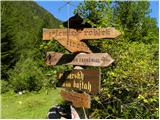 2
2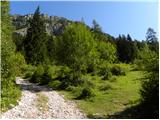 3
3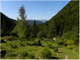 4
4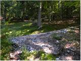 5
5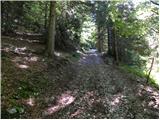 6
6 7
7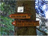 8
8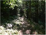 9
9 10
10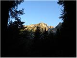 11
11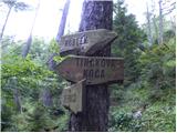 12
12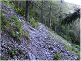 13
13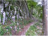 14
14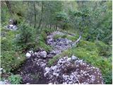 15
15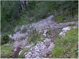 16
16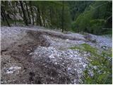 17
17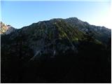 18
18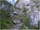 19
19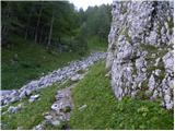 20
20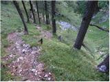 21
21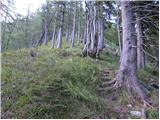 22
22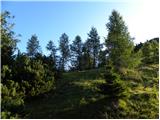 23
23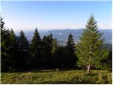 24
24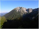 25
25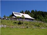 26
26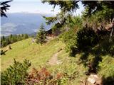 27
27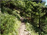 28
28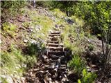 29
29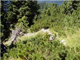 30
30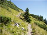 31
31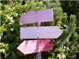 32
32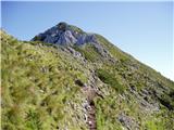 33
33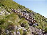 34
34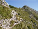 35
35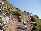 36
36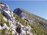 37
37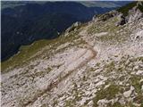 38
38 39
39