Tourist farm Perk - Matkova kopa (shepherd-hunting path)
Starting point: Tourist farm Perk (1230 m)
Starting point Lat/Lon: 46.4152°N 14.6013°E 
Path name: shepherd-hunting path
Time of walking: 3 h 30 min
Difficulty: very difficult pathless terrain
Difficulty of skiing: no data
Altitude difference: 727 m
Altitude difference (by path): 1050 m
Map: Kamniške in Savinjske Alpe z Obirjem in Peco
Access to starting point:
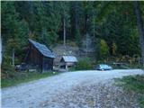
From the Kranjska side over Kranjski Rak or from the Štajerska side past Mozirje we drive through Luče and ahead towards Logarska dolina. At the turn-off for Logarska dolina we continue driving forward towards the border crossing Pavličevo sedlo and about a kilometer higher we turn left over a bridge into Matkov kot. At the smaller power station the macadam starts. On the right is a turn-off towards the tourist farm Gradišnik (homestead of the known Slovenian zitherist Karli Gradišnik). We drive straight ahead on the macadam past farms Kočnar and Matk to farm Perk (smaller sawmill on the right side and enclosure for pigs on the left side of the road). There we kindly ask where we can park, so that our parking does not obstruct their work.
Path description:
We park at the farm Perk or in its vicinity. Our path starts at Perk's sawmill on a forest track right steeply upwards. A little higher we come on the ridge to a marked path-track, which immediately in a short distance turns left twice. Then the path-track directs right straight along the ridge upwards and thereby twice crosses a forest road. Above the second crossing the marked path-track soon turns right, we go straight and immediately again left on a poorly visible path. The path takes us across a small stream after about 100 m to a forest clearing (path disappears here) along which we continue on the right side to Lesnikovo sedlo a little higher. There we come to a forest road, which leads us left across the clearing upwards. Then we turn right upwards on a track to the upper side of the clearing. At the end of the track and clearing begins a nice shepherd-hunting path. A little higher we climb right to Jerebičje (we can also go diagonally, paths then join again). We continue along the ridge of Jerebičje and then descend down to Matkovo sedlo. The saddle is like a long almost flat grassy back, with a smaller decaying hut under the left edge, surrounded by forest. The path is here very poorly visible. At the end of the saddle we climb steeply upwards along a vegetated ridge. The path is again well visible. Soon behind us are also Matkov Grintovec and Jevševec. The ascent to them takes us little time, since they are only a little above the path. The easiest access to them is at their end (not at the beginning), viewed in the direction of travel. A little further the path descends very steeply far down past a precipitous gully on the left, across the clearing past the salt lick to the gully below. Then we cross the gully and climb on the other side steeply upwards. The path ahead is easier, but several times very exposed and dangerous for slipping. Several times we descend a little and climb, which our legs also let us know. After a longer crossing of the dwarf pine-covered slopes of Matkove kope we come to the gully (usually there is a cairn, if not we place one), along which the last part of the ascent to the summit begins. There is no path from here onwards.
The further ascent is hard to describe. While advancing through the gully above it we notice a pointed rocky summit, towards which we must go. From the entry gully we climb to a less pronounced one right under it, and along its (right) edge we ascend to the dwarf pines. Then a few steps again right, a little upwards, then again a little right and up (visible traces of treading - probably hard to believe from a human). Without greater struggle with dwarf pines we are at the lower edge of the scree (for those coming after we place a cairn). From here onwards there are no more major orientation loops. Along the edge of the scree we climb under the walls, where we direct to the right. The easiest approach to the summit of Matkove kope from here indeed runs near the right edge. The nicely visible steep gully left beside it is easiest to tackle straight upwards. When we climb this part the summit of Matkove kope is in front of us.
On the way: Lesnikovo sedlo (1517m), Jerebičje (1761m), Matkovo sedlo (1623m), Matkov Grintovec (1700m), Jevševec (1730m)
Pictures:
 1
1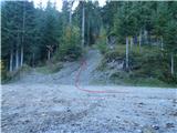 2
2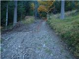 3
3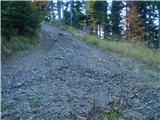 4
4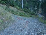 5
5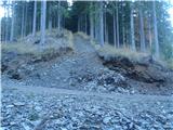 6
6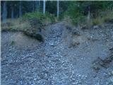 7
7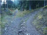 8
8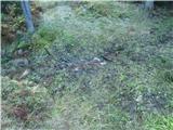 9
9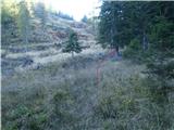 10
10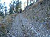 11
11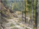 12
12 13
13 14
14 15
15 16
16 17
17 18
18 19
19 20
20 21
21 22
22 23
23 24
24 25
25 26
26 27
27 28
28 29
29 30
30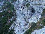 31
31 32
32 33
33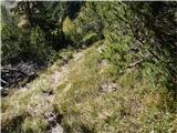 34
34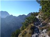 35
35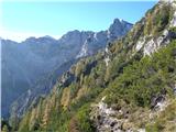 36
36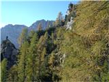 37
37 38
38 39
39 40
40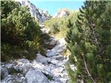 41
41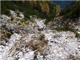 42
42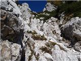 43
43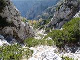 44
44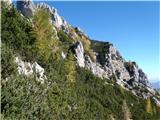 45
45 46
46 47
47 48
48 49
49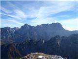 50
50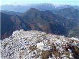 51
51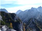 52
52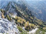 53
53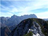 54
54