Trbovlje - Sveta planina (Partizanski vrh)
Starting point: Trbovlje (299 m)
| Latitude/Longitude: | 46,1647°N 15,048°E |
| |
Walking time: 2 h
Difficulty: easy marked way
Elevation gain: 712 m
Elevation difference along the route: 712 m
Map:
Recommended equipment (summer):
Recommended equipment (winter):
Views: 23.822
 | 1 person like this post |
Access to starting point:
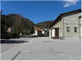
From the regional road Hrastnik - Litija, at the traffic light intersection on the periphery of Trbovlje we turn right or left if coming from the Ljubljana direction, and drive to the center of Trbovlje. We continue driving in the direction of Prebold, but follow the road only to Gornje Trbovlje, where at the traffic light intersection we continue left onto Cesta Tončke Čečeve, along which we then also park at one of the parking lots (during working days, the parking lots are reserved for employees of nearby companies).
Route description:
From the starting point, we continue on the road by which we've parked, and then at the smaller intersection at the chapel, we continue left on a narrow and ascending road (by the intersection we notice signs for Sveta planina / Partizanski vrh). The road ahead leads past a few houses, and then passes onto grassy slopes, over which we ascend to the last house.
Behind the last house, we look for a marked cart track which further ascends along the edge of the forest. Higher, the moderately steep cart track passes into a belt of bushes, and then brings us to an abandoned house, behind which we step onto an asphalt road. We follow the mentioned road to the right, which quickly brings us to the next intersection, where we continue left in the direction of Sveta planina. Further, we ascend past a few houses, after which a path joins from the left that starts in the lower part of Trbovlje.
We continue on the increasingly panoramic road, which has meanwhile lost its asphalt surface, and follow it to the "last" house in Planinska vas. We continue the ascent on a wide and well-marked cart track which first leads along the edge of the forest and then, after bypassing a few houses on the right side, passes into a somewhat denser forest. Higher, the cart track brings us to the edge of extensive and steep grassy slopes, from which a nice view opens onto the western part of Posavsko hribovje. A little further ahead the path turns sharply to the right and passes into a dense forest, through which it ascends transversely. Higher we step out of the forest again, where ahead of us we already see the church of St. Mary and a little further the inn Planina. From the inn or the little church, only a short ascent separates us from the summit of Sveta planina.

Photos:
 1
1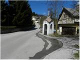 2
2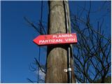 3
3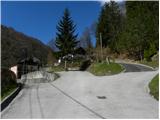 4
4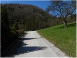 5
5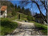 6
6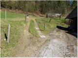 7
7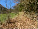 8
8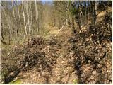 9
9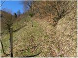 10
10 11
11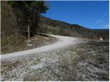 12
12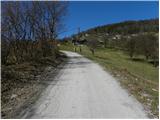 13
13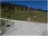 14
14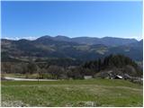 15
15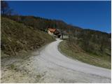 16
16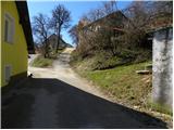 17
17 18
18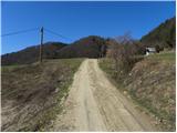 19
19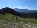 20
20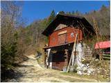 21
21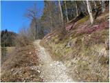 22
22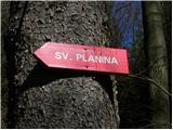 23
23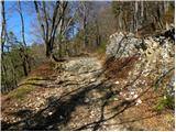 24
24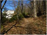 25
25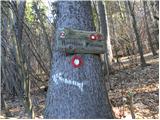 26
26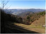 27
27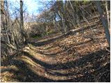 28
28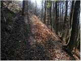 29
29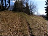 30
30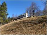 31
31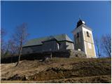 32
32 33
33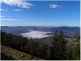 34
34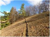 35
35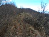 36
36 37
37
Discussion about the trip Trbovlje - Sveta planina (Partizanski vrh)
|
| generacija3. 06. 2012 |
Since we are not locals, we were looking for the starting point to Sv. Gora in Trbovlje, but couldn't find it. When we reached the beginning of ul. Tončke Čečeve, "we oriented ourselves according to the instructions and description above", there was one mark on the street lamp post, but no more after that.
We drove to Čebin and parked there and continued on foot to Partizanski vrh.
I think they should arrange the markings if this is an official hiking trail.
|
|
|
|
| N3bULA17. 07. 2021 22:28:21 |
They removed the viewpoint platform at the top, shame.
The hut shows no signs of life, looks like COVID finished them off.
|
|
|
|
| Stamp24. 09. 2021 21:11:10 |
So - in Gostilna Planina there's nothing to eat?
|
|
|
|
| Stamp11. 03. 2022 09:41:41 |
No, because it's not working..
We went in a loop, from Gabrsko, but joined the trail from Trbovlje for about 3km..
A bit along it, then after the ex inn a bit along that trail to Vrhe and at the end again unmarked variant of descent towards the parking..
Wiki track
|
|
|
To post a comment you must log in:
If you do not yet have a username, you must first
register.