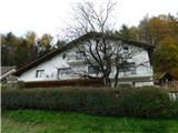
Tourist farm Žurej - Church of St. Helena on Javor
Starting point: Tourist farm Žurej (313 m)
Starting point Lat/Lon: 46.16704°N 15.46852°E 
Time of walking: 45 min
Difficulty: easy marked way
Difficulty of skiing: no data
Altitude difference: 215 m
Altitude difference (by path): 215 m
Map:
Access to starting point:
We leave the Štajerska highway at the Dramlje exit, then follow the signs for Šentjur. From the center of Šentjur, we continue briefly towards the settlement of Šmarje pri Jelšah, but soon turn right onto the road towards Podsreda and Planina pri Sevnici. When Šentjur ends, we soon turn left from the main road in the direction of Podsreda, Kozje, and Gorica pri Slivnici. When we get to the settlement Gorica pri Slivnici, we go from the roundabout on the exit for Sodna vas and Sveti Štefan. When Gorica pri Slivnici ends, the path leads us by lake Slivniško jezero, and a little further, we turn right in the direction of Hrastje, Dobrina, and Tourist farm Žurej. On the mentioned road, we drive to the mentioned farm, where we turn left into a parking lot by hiking signposts.
Path description:
From the parking lot, we head on the path toward Sveta Helene and Slivnica and continue walking on the asphalt road. We soon reach a crossroad, where we turn right toward Sveta Helene. We continue on a side road that gradually starts to climb, occasionally passing by a house or through a stretch of forest. At a few smaller crossroads, we follow the trail markers, continuing along the road from which increasingly beautiful views open up, all the way to the NOB monument, where an inscription box is located.
A few 10 meters beyond the inscription box is also the church of Sveta Helene.
Description and pictures refer to the condition in November 2023.
Pictures:
 1
1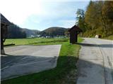 2
2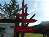 3
3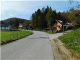 4
4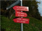 5
5 6
6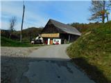 7
7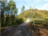 8
8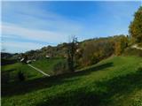 9
9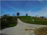 10
10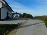 11
11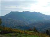 12
12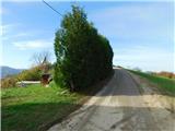 13
13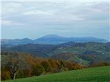 14
14 15
15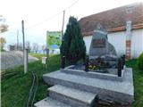 16
16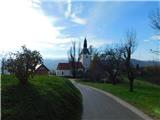 17
17