Turkov rovt (Vrata) - Požgana Mlinarica
Starting point: Turkov rovt (Vrata) (941 m)
Starting point Lat/Lon: 46.4179°N 13.858°E 
Time of walking: 2 h 45 min
Difficulty: easy pathless terrain
Difficulty of skiing: no data
Altitude difference: 927 m
Altitude difference (by path): 927 m
Map: Triglav 1:25.000
Access to starting point:
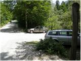
We leave the Gorenjska motorway at the Jesenice - west (Hrušica) exit and continue driving in the direction of Kranjska Gora. A little before Dovje, signs for Mojstrana, Krma, Kot and Vrata direct us to the left onto a somewhat narrower road, along which we quickly arrive in Mojstrana. Through Mojstrana we follow the signs for the alpine valley Vrata, and we follow the mentioned road for good 10.5 km (signs along the road), then on the left side we notice a brook and across it a poor forest road which is closed with a barrier. We park in a suitable place between the road and the brook, of course in such a way that we do not obstruct the passage across the water.
Path description:
From the parking lot, we first cross the river Bistrico; on the other side we continue only a few meters to the right and then turn left uphill onto a footpath. The path then ascends quite steeply through the forest for some time and later brings us out of the forest onto extensive scree fields. We continue along a well-visible trail, which a little further turns right so as to avoid the steep slopes on the left side of the valley. We ascend the scree to the foot of the walls, where the path turns left and then ascends diagonally across the scree.
When we come above the steep slopes on the left side of the valley, we do not continue right along the valley Za Cmirom, but continue straight ahead and cross the valley in a gentle descent towards the steep walls of the ridge of Vrbanove špice. After crossing the valley, we head even more to the left towards the scree (northeast of Spodnja Vrbanova špica), which leads towards the slopes of Požgana Mlinarica. Požgana Mlinarica has been well visible from the path for some time and from here is visible as the first vegetated peak in the ridge (viewed from right to left).
At first we ascend diagonally across a slope strewn with numerous rocks, but when we reach the scree with smaller stones we will also notice a trail leading upwards across the scree. At the end of the scree we continue along the trail, which leads us left through dwarf pines and larch forest. The path is sufficiently well visible further on and we can follow it without major difficulties. In the final section, the path ascends more steeply a few times and brings us to a very panoramic summit.
Pictures:
 1
1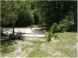 2
2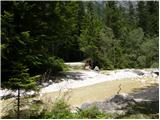 3
3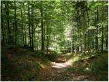 4
4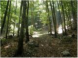 5
5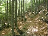 6
6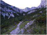 7
7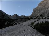 8
8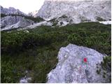 9
9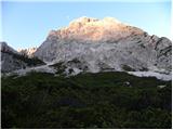 10
10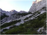 11
11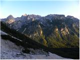 12
12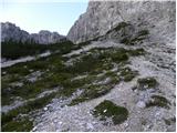 13
13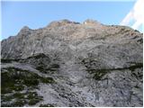 14
14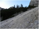 15
15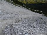 16
16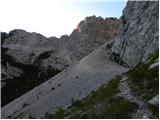 17
17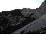 18
18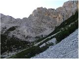 19
19 20
20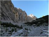 21
21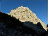 22
22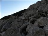 23
23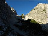 24
24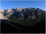 25
25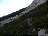 26
26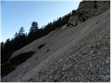 27
27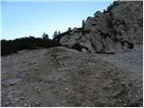 28
28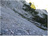 29
29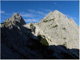 30
30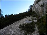 31
31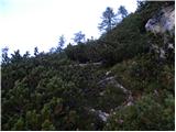 32
32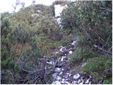 33
33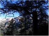 34
34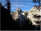 35
35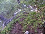 36
36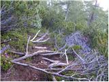 37
37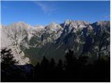 38
38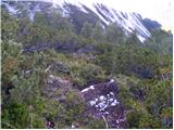 39
39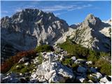 40
40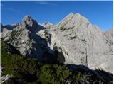 41
41 42
42