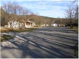
Starting point: Vilenica (420 m)
| Latitude/Longitude: | 45,6747°N 13,9116°E |
| |
Walking time: 45 min
Difficulty: easy marked way
Elevation gain: 183 m
Elevation difference along the route: 200 m
Map: Slovenska Istra - Čičarija, Brkini in Kras 1:50.000
Recommended equipment (summer):
Recommended equipment (winter):
Views: 8.505
 | 1 person like this post |
Access to starting point:
From the Ljubljana - Koper highway, take the Divača exit and follow the road ahead in the direction of the villages Lokev and Lipica. The road then quickly brings us to the village of Lokev, where at the end of it we will come to a crossroads, where a road towards Vilenica Cave branches off to the right. We turn onto this road, from which soon a road branches off to the right (the turn-off is marked), which after 100 m brings us to the parking lot at Vilenica Cave.
Route description:
From the parking lot, we walk through a meadow to the mountain signposts, which we see on the other side of the already mentioned meadow. We continue right in the direction of the village Lokev (left Sežana) on a cart track, which in a few minutes of walking past the bushes brings us to a well-marked junction.
We continue left slightly upwards on a cart track in the direction of Stari tabor and village Povir. We continue the ascent on a cart track which goes into the forest and further slightly ascends. The well-marked cart track, which has a few smaller junctions, changes higher up into a pleasant footpath. The mentioned path, which becomes a little steeper, is joined a few meters below the summit by the path from the village Povir. We continue right and past the cribs (when they are there) in a few steps we ascend to the panoramic summit.
Photos:
 1
1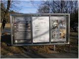 2
2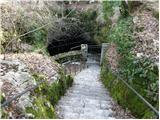 3
3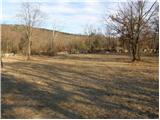 4
4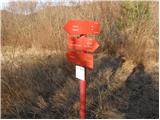 5
5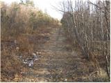 6
6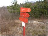 7
7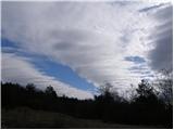 8
8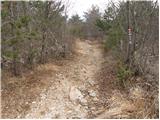 9
9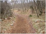 10
10 11
11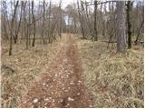 12
12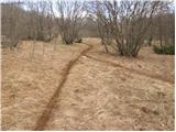 13
13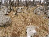 14
14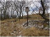 15
15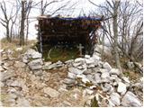 16
16 17
17
Discussion about the trip Vilenica - Stari tabor
|
| grega_p28. 03. 2010 |
At one unmarked junction, follow the more trodden and hardened cart track, otherwise a very nice and marked path. For such a low hill, imo, impressive view!
But who knows the origin of the name, where does Stari tabor come from - who camped there?
Happy trails to all!
|
|
|
|
| bruny5. 03. 2012 |
According to sources, Stari tabor was settled already before millennia and due to the good location probably  the name too.... the name too....
Source:Wikipedia
|
|
|
|
| adry1. 02. 2021 |
Stari tabor is very popular during the COVID time as a favorite recreational spot for locals every day.
In winter time, due to its bareness, it is a very scenic summit with views of surrounding peaks, Nanos, Vremščica, Snežnik, Kanin mountain range and of course from the top we can see the sea too.
The summit has been popular among people from Povir and Lokve since 1998, when the path to the summit was marked and a box with a logbook was placed.
And a bit of historical information as a response to the previous two comments.
The summit of Stari Tabor above Vilenica cave is a clear strategic point, on which there are remains of prehistoric fortifications and later traces of buildings, including mortar walls surrounding the summit. (local lexicon SLO, 1968)
At this prominent point stood a "castellier" or fortification, which was part of the so-called Illyrian-Celtic limes. It was built due to the incursion of Roman legions from the post Tergestum (Trieste).
It was built by the tribes of the Karsov, Rodniktov and Venetov. It became booty of the Roman Empire and served it from the incursions of peoples from the east, Huns, Avars, Vandals, etc., who destroyed all local fortifications and castelliere. Upon the arrival of our ancestors, only ruins stood here.
The name Stari tabor has been preserved by oral tradition to this day. (as written in the logbook in 1998 by local from Lokve Boris Čok)
The ruins still show us today that there was probably a wall from prehistoric times, which served as defense against enemy attacks and is said to have existed until the arrival of the Romans. On the trail as we approach the summit, we notice remains of mortar and wall ruins that circularly extend towards the eastern part of the hill. Folk tradition says that the fortification at Stari tabor was connected by an underground tunnel to the round stool that stood on Tabor (525 m) above Povir and that treasures were hidden in it.
We used information about Stari Tabor for organized hikes that we organized for 18 years in our sports club.
|
|
|
To post a comment you must log in:
If you do not yet have a username, you must first
register.