Starting point: Vršič (1611 m)
| Latitude/Longitude: | 46,43360°N 13,74350°E |
| |
Walking time: 5 h 5 min
Difficulty: difficult marked way
Elevation gain: 842 m
Elevation difference along the route: 1200 m
Map: TNP 1:50.000
Recommended equipment (summer): helmet, self belay set
Recommended equipment (winter): helmet, self belay set, ice axe, crampons
Views: 15.371
 | 3 people like this post |
Access to starting point:
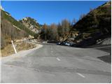
From Kranjska Gora we drive towards Bovec or vice versa, but only to the Vršič pass, where we park.
Route description:
From the parking lot we head onto the road in the direction of Trenta and at the end of the parking lot we reach a small intersection, where we continue left onto the side road, which after a short ascent leads us to Tičarjevega doma na Vršiču.
From Tičarjevega doma we continue along the gravel road along which there are signs for Poštarski dom and along which we begin to ascend moderately across scenic slopes. While looking at the surrounding peaks, we quickly arrive at the marked junction.
Here we continue right in the direction of Prisanka and Razorja (straight along the road to Poštarski dom and the summit of Vršiča) and continue the trail along a well-trodden hiking path, which for some time continues along a gentle and scenic ridge. After a few minutes the path begins to ascend more steeply through a sparser belt of dwarf pines, then it levels out and leads us right below the summit of the grassy Sovne glave.
From Sovne glave follows a short descent to Sedla za Sovno glavo and we are already at the next junction, where we continue straight or slightly right (to the left the path leads to Prisank through Prednje okno). In the continuation across the scree we cross the slopes on the western side of Prisanka or Prisojnika. The path ahead ascends a little more and leads us to the place where to the left the Grebenska pot branches off to Prisank, straight ahead continues the path that leads to Razor, Pogačnikov dom and Prisank (Prisank Slovenska pot and Jubilejna pot and Razor južna pot).
We continue straight and the path quickly branches again.
To the left the Slovenska pot branches off to Prisojnik and the path towards Kajzljevi škrbini. We continue right following the signs for Razor (južna pot) and begin to descend slightly. The path then moves to the southern slopes and crosses the slopes towards the east. At some places we are also helped by some pegs and steel cables and then we reach grassy slopes. After a longer crossing we arrive at the Mlinarica junction, where the path branches.
We continue right towards Razorju and Pogačnikovemu domu (left Jubilejna pot to Prisojnik), where in the continuation we first cross the slopes below Razorjem, a little further it leads us to the entry into the technically more demanding section. Here with the help of fixed protections we climb a shorter wall, the ascent in this part does not cause any serious difficulties. Higher up the path turns south towards Utrujenemu stolpu, and we with ever better views continue to sedla Planja, where we join the path from Kriških podov.
We continue right in the direction of Planje (straight down to Pogačnikov dom, left Razor) along the path that in a traversing ascent with the help of fixed protections climbs to the summit slope of the mountain. Here the steepness eases and the increasingly scenic path, from which beautiful views open to the highest peaks of the Julian Alps, leads us in a few further minutes to the spacious summit.
Vršič - razpotje pod Bavho 0:15, razpotje pod Bavho - Sovna glava 0:15, Sovna glava - Sedlo za Sovno glavo 0:05, Sedlo za Sovno glavo - Gladki rob 0:25, Gladki rob - Kranjska planina 0:20, Kranjska planina - odcep za Jubilejno pot 1:45, odcep za Jubilejno pot - Sedlo Planja 1:30, Sedlo Planja - Planja 0:30.

Along the route: Tičarjev dom na Vršiču (1618m), Razpotje pod Bavho (1680m),
Sovna glava (1750m), Sedlo za Sovno glavo (1715m), Gladki rob (1869m), Kranjska planina (1672m), Mlinarica (1799m), Odcep za Jubilejno pot (2006m), Sedlo Planja (2352m)
Photos:
 1
1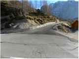 2
2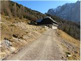 3
3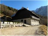 4
4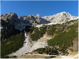 5
5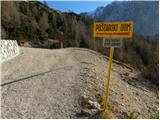 6
6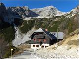 7
7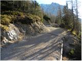 8
8 9
9 10
10 11
11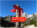 12
12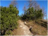 13
13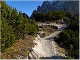 14
14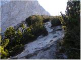 15
15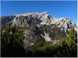 16
16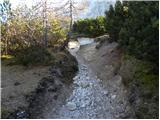 17
17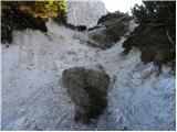 18
18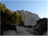 19
19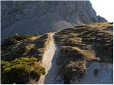 20
20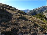 21
21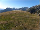 22
22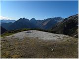 23
23 24
24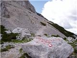 25
25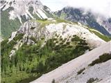 26
26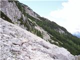 27
27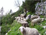 28
28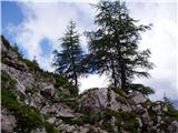 29
29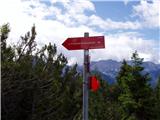 30
30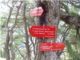 31
31 32
32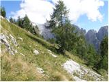 33
33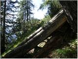 34
34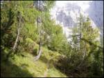 35
35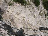 36
36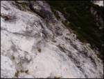 37
37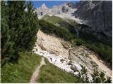 38
38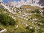 39
39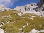 40
40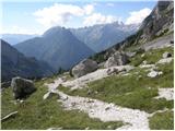 41
41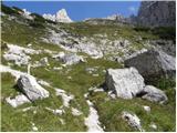 42
42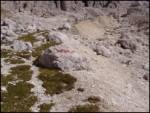 43
43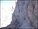 44
44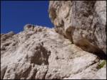 45
45 46
46 47
47 48
48 49
49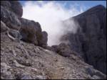 50
50 51
51 52
52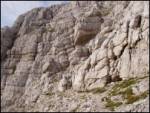 53
53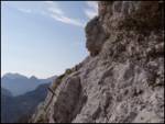 54
54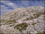 55
55 56
56
Discussion about the trip Vršič - Planja
To post a comment you must log in:
If you do not yet have a username, you must first
register.