Weinebene - Glashüttenkogel
Starting point: Weinebene (1668 m)
Starting point Lat/Lon: 46.8401°N 15.0162°E 
Time of walking: 1 h 10 min
Difficulty: easy marked way, easy pathless terrain
Difficulty of skiing: no data
Altitude difference: 94 m
Altitude difference (by path): 140 m
Map:
Access to starting point:
A) Over one of the border crossings with Austria (Korensko sedlo, Karawanks Tunnel, Ljubelj Pass, Jezerski vrh Pass, Pavličev vrh Pass) we drive to Austria, and then we continue driving on the so-called southern motorway towards Graz. On the mentioned motorway we drive to the settlement of Wolfsberg, where we leave the motorway, and when we get to the old or regional road we continue driving in the direction of the settlement of St. Gertraud. In the settlement of St. Gertraud we notice signs for the Alpine pass Weinebene, which point us to the right on an ascending asphalt road. On the mentioned road, we drive approximately 18 km, and then we get to the mentioned Alpine pass, which is situated at an altitude of 1668 m. We park on a large marked parking lot by the pass.
B) Over the border crossing Holmec or Vič we drive to Austria, and then we continue driving towards the settlement of Wolfsberg. From Wolfsberg we continue on a regional road in the direction of the settlement of St. Gertraud. In the settlement of St. Gertraud we notice signs for the Alpine pass Weinebene, which point us to the right on an ascending asphalt road. On the mentioned road, we drive approximately 18 km, and then we get to the mentioned Alpine pass, which is situated at an altitude of 1668 m. We park on a large marked parking lot by the pass.
C) First, we drive to Maribor, and then we continue driving on the motorway towards the border crossing Šentilj and further on the Austrian motorway towards Graz. We leave the mentioned motorway at the exit for the settlement of Lipnica / Leibnitz. When we leave the motorway at the roundabout, we continue in the direction of the settlement of Lipnica / Leibnitz and further we drive south from the village Gralla, which is today already some kind of peripheral part of Lipnica. Further, the road leads us past an industrial or commercial zone, and at the roundabout by the Hofer store we continue "straight" on the second exit in the direction of the settlement of Lonč / Deutschlandsberg. Further, we drive for some time on the main road, and after the village Graschach we turn right in the direction of the settlement of Lonč / Deutschlandsberg. In a roundabout right next to the settlement of Lonč / Deutschlandsberg, we continue "straight" in the direction of the Alpine pass Weinebene. From here on, the road starts ascending steeper, and we follow it approximately 20 km to the already mentioned pass, where we park on an organized parking lot.
Path description:
From the parking lot on the Weinebene pass we head onto the marked footpath, which from the pass continues towards the north. The path first leads us across a gentle pasture, then past a chapel gradually into a sparse forest. When we enter the forest, the path becomes somewhat steeper, and it leads us to a marked junction, where we continue right in the direction of Mörtlkreuz, Parfurßvit, Deutschlandsberg (Lonč in Slovene), Handalmkreuz, Poschalmkreuz and Osterwitz. The path ahead ascends diagonally to the right and quickly brings us to a nice viewpoint, which is just a few meters off the marked path. We continue straight ahead, and the path, slowly turning left, crosses a few springs. The moderately steep path higher up flattens out completely and leads us across a panoramic grassy slope. A short easy descent follows, and the path brings us to a junction at the Handhöhkreuz cross.
Here we continue right and first descend along a nicely groomed path that leads us across a short swampy area. A moderate ascent to the summit of Moserkogel (1747 m) follows, then a somewhat longer gentle descent towards the neighbouring summit. The panoramic path then begins to ascend again slightly to moderately and gradually brings us to the southwest slopes of the Glashüttenkogel summit. When the marked path higher up flattens out completely, we leave it at a suitable spot and continue left through easier pathless terrain. We then ascend a somewhat steeper grassy slope, and the "path" brings us to the panoramic summit (there are two summits and both are approximately equally high).
On the way: Moserkogel (1747m)
Pictures:
 1
1 2
2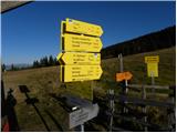 3
3 4
4 5
5 6
6 7
7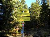 8
8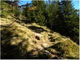 9
9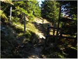 10
10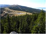 11
11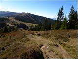 12
12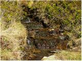 13
13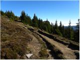 14
14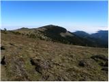 15
15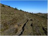 16
16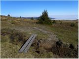 17
17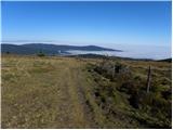 18
18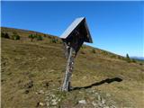 19
19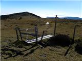 20
20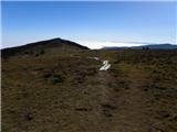 21
21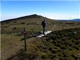 22
22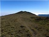 23
23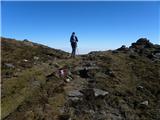 24
24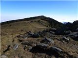 25
25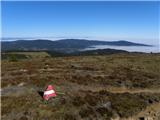 26
26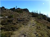 27
27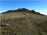 28
28 29
29 30
30 31
31 32
32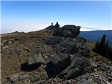 33
33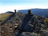 34
34