Weissensee - Almspitz (via Techendorfer Alm)
Starting point: Weissensee (940 m)
| Latitude/Longitude: | 46,6989°N 13,4148°E |
| |
Route name: via Techendorfer Alm
Walking time: 4 h
Difficulty: easy marked way
Elevation gain: 1240 m
Elevation difference along the route: 1240 m
Map:
Recommended equipment (summer):
Recommended equipment (winter): ice axe, crampons
Views: 4.265
 | 1 person like this post |
Access to starting point:
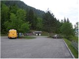
A little before Spittal from the direction of Beljak/Villach (on the old road), the road towards the village Ziebel branches off to the left. In the mentioned village, we continue driving towards the lake Weissensee, which is approximately 15 km from Ziebel. We park on a large well-maintained parking lot near the lake.
Route description:
From a large parking lot, we descend a few meters to the main road, where on the left side we notice signposts. We head on a wide path which leads by the lake following the signs »Techendorf«. The path first leads us over a smaller bridge and brings us to a camp on the eastern side of the lake Weissensee. Here we go right on an asphalt road which runs by the camp and brings us to a crossroad where we go left and after a few meters of walking, we come to the signposts. We go left following the signs »Techendorfer Alm steil«. After a few meters, we come again to signposts and go right on a steep path towards the mountain pasture Techendorfer Alm. The left path runs on a more gentle route, which mostly leads on the road.
The path quite steeply ascends through the forest and brings us to a clearing where we cross a cart track and start ascending along the edge of the forest. Here already first views open up towards the nearby peaks in Latschur group. The path again ascends through the forest and then several times crosses the mountain road. At all crossroads, which are very well marked, we continue in the direction of Techendorfer Alm steil (steep path). Finally, when the path towards the saddle Stosia branches off to the left, we continue on the road which after approximately 15 minutes of walking brings us to the mountain pasture Techendorfer Alm, where there stands also a smaller mountain hut.
From the mountain pasture, we continue towards the north following the signs Stosia, Latschur. The path first crosses a sparse forest and then ascends on grassy slopes towards the saddle Stosia. This part of the path is marked with white-blue blazes.
On the saddle, we go right and continue on a grassy ridge. When we come to a crossing we continue straight on the ridge, and the direct path to Eckwand branches off to the right. When we come again to a crossing we go on the right path, which still runs on the ridge and leads to Almspitz (2180m). The left path leads to Latschur. The path then continues ascending on a grassy ridge and soon brings us to the summit Almspitz from which there is a nice view towards the surrounding peaks.

Photos:
 1
1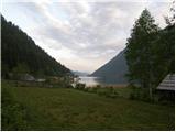 2
2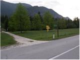 3
3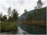 4
4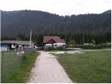 5
5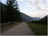 6
6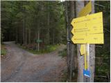 7
7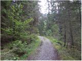 8
8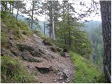 9
9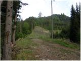 10
10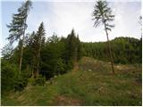 11
11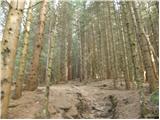 12
12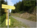 13
13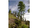 14
14 15
15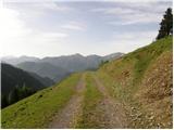 16
16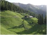 17
17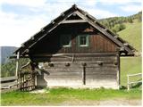 18
18 19
19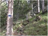 20
20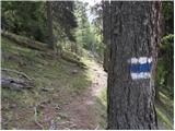 21
21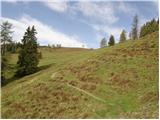 22
22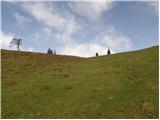 23
23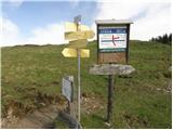 24
24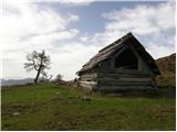 25
25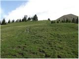 26
26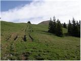 27
27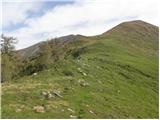 28
28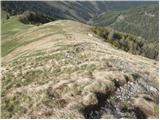 29
29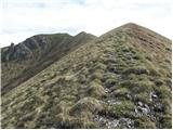 30
30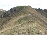 31
31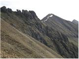 32
32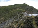 33
33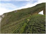 34
34 35
35
Discussion about the trip Weissensee - Almspitz (via Techendorfer Alm)
|
| dusanw12. 12. 2010 |
Very nice hike but how does it look in winter.
|
|
|
|
| 2061alessio14. 12. 2010 |
I did a circular tour with a friend on 6.6.2010, parked the car near photo no.7 and up path no.265 to Stosia Alm (elevation 1.811, h:1.30), then to Latschur summit (elevation 2.236, h:2.45), then path no.20 to Eckwand summit (elevation 2.221, h:3.30), descent to Eckwand saddle (h:3.40), ascent to Kopasnock summit (h:4.00) and then descent to Mitte Staff saddle via path no. 21 (h:4.10), further on unmarked path and steep meadow to an alm at elevation 1.652 (h:5.15), now on marked path and forest road to Mosslacher Alm (elevation 1447) and further on the same road through the waterfalls in Silbergraben (h:6.15) to the car (h: 6.50); it could also be done from the ski area but orientation between Mitte Staff saddle and Mosslacher Alm is already a bit tricky in summer, still quite panoramic circular summer tour.
|
|
|
To post a comment you must log in:
If you do not yet have a username, you must first
register.