Starting point: Zali Log (522 m)
Starting point Lat/Lon: 46.2059°N 14.1109°E 
Time of walking: 2 h 45 min
Difficulty: easy marked way
Difficulty of skiing: no data
Altitude difference: 871 m
Altitude difference (by path): 900 m
Map: Škofjeloško in Cerkljansko hribovje 1:50.000
Access to starting point:
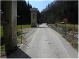
A) First, we drive to Škofja Loka, and then we continue driving towards Železniki and further towards Zali Log. About 100 meters before Zali Log, we will come to an intersection, where the road towards Davča branches off to the left. Here we turn left, cross the bridge over the river Selška Sora and park in a suitable spot next to the transformer.
B) We can also reach the starting point from the direction of Tolmin. In this case, first we drive to Podbrdo, and then we continue driving towards Železniki. At the first intersection after Zali Log we turn right and then park in a suitable spot next to the transformer.
Path description:
On the nearby hayrack by the transformer we notice signs for Blegoš, which direct us onto the road along which we parked. The road initially ascends gently along the river Davča and further leads us through the hamlet of Zali Log. In the second part of the hamlet we come to a somewhat larger intersection, where the road towards Davča, the Cerkno ski slope and Cerkno branches off to the right, and we continue straight across the bridge to the NOB monument. At the monument below the power line a marked cart track branches off slightly to the right (the branch-off is unmarked), which leads to Blegoš (Blegoš over Potok), and we continue straight on the asphalt road, which further moderately ascends along the stream Muštrova grapa. After a few minutes of further walking we arrive at a smaller intersection, where signs for the hiking path and the homesteads Pr' Muster and Pr' Dobret direct us left onto a narrower road, which gradually begins to ascend more steeply. A little higher the asphalt road turns sharply left to the farm Pr' Muster, and we continue slightly right on a macadam road which in a few hairpin turns steeply ascends to the farm Pr' Dobret.
From the mentioned farm we continue left along the cart track, which ascends across a panoramic grassy hay meadow. When we reach the edge of the forest we continue right and with views of Ratitovec and the surrounding hills we walk to the place where the marked path (cart track) turns left into the forest. Next we ascend along a cart track that is steep for a short time, which soon flattens, then splits several times. (So as not to go astray at the forks, we carefully follow the otherwise rare blazes).
From the place where the cart track flattens, we cross the slopes towards the left for some time, then ascend more steeply along a tractor track, along which we quickly arrive at a smaller saddle. At the saddle we continue right and continue the path along the cart track, which first ascends along a smaller ridge, higher splits a few times (we follow the blazes), then passes to the left side of the nearby hill (Mrzli vrh). A little further ahead the path brings us to the Mrznikar farm, from where we continue the ascent along the cart track that begins at the nearby chapel. Further we cross a panoramic slope, then the path enters the forest, through which it continues to the asphalt road at the Čemšišar homestead. From there we go in the direction of Blegoš and Koprivnik and continue along the forest road. After some 10 m of walking along the mentioned road we arrive at a marked junction, where we continue left onto the cart track in the direction of Koprivnik and Romovec (right Blegoš). We continue the ascent along the cart track, which quickly brings us to the water tank, which we bypass on the right side. The path ahead gradually begins to ascend more steeply and leads us constantly, except for a few short marked shortcuts, along the cart track. At the top of the ascent the path brings us to the saddle between Koprivnik on the left and Romovec on the right.
Here at the saddle, where there is also a logbook box and next to it a larger bench, we continue left (right Romovec, Črni Kal and Blegoš) and continue the path along the cart track, to which already after a few meters a marked path from Žetina joins from the right.
We follow the cart track in the direction of Koprivnik (right downhill Žetina), which gradually begins to ascend more steeply. At the place where the cart track begins to be overgrown by high grass, we will notice on the right side at first a poorly visible but marked footpath, which branches off to the right from the cart track. Further we ascend initially through very dense forest along the path, which higher brings us to partly panoramic slopes, from which a view opens onto the nearby Blegoš. A little further the steepness eases and the path across the blueberry patch quickly brings us to the summit of Koprivnik.
Pictures:
 1
1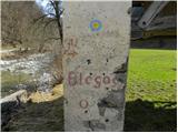 2
2 3
3 4
4 5
5 6
6 7
7 8
8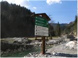 9
9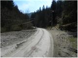 10
10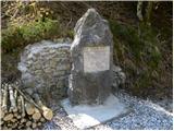 11
11 12
12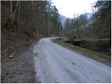 13
13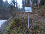 14
14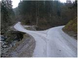 15
15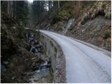 16
16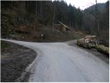 17
17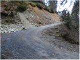 18
18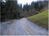 19
19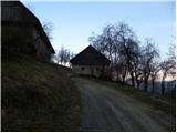 20
20 21
21 22
22 23
23 24
24 25
25 26
26 27
27 28
28 29
29 30
30 31
31 32
32 33
33 34
34 35
35 36
36 37
37 38
38 39
39 40
40 41
41 42
42 43
43 44
44 45
45 46
46 47
47 48
48 49
49 50
50 51
51 52
52 53
53 54
54 55
55 56
56 57
57 58
58 59
59 60
60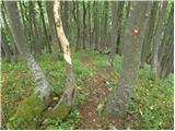 61
61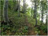 62
62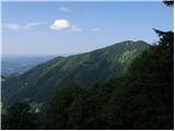 63
63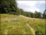 64
64 65
65 66
66