Starting point: Zalog (600 m)
Starting point Lat/Lon: 46.3281°N 14.363°E 
Time of walking: 3 h
Difficulty: easy marked way
Difficulty of skiing: demanding
Altitude difference: 1115 m
Altitude difference (by path): 1115 m
Map: Karavanke - osrednji del 1:50.000
Access to starting point:
From the highway Ljubljana - Jesenice, take the exit Kranj West and follow the road ahead in the direction of Golnik. Soon after the village Tenetiše, we will notice signs for the village Goriče, which direct us right onto a local road. A little further on, we come to the next intersection, where we continue right in the direction of the villages Trstenik and Preddvor. Nor do we follow this road for long, as already after a few metres we will notice a sign for Zalog, which directs us left onto an ascending road, which we then follow to the mentioned village. In the middle of the village, a little before the church, we will notice a road that branches off to the right from the main road. We take this road, beside which we soon notice blazes. We follow this road for approximately 1 km more, then park on one of the parking areas alongside the road.
Path description:
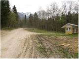
From the starting point, we continue on the road alongside which we parked, but it becomes progressively worse and brings us higher to the NOB monument, where we leave it and continue the ascent right on the ascending cart track. At the spot where the cart track, along which we continue the ascent, turns left, we will notice a footpath on the right side, which starts to ascend more steeply through the forest (the beginning is not marked).
The path, alongside which we notice rare blazes, then takes us past a small chapel to a poorly marked junction, beside which on a panoramic rise we notice a pleasant bench.
We continue slightly left in the direction of Mala Poljana (the signpost is somewhat further ahead from the junction) along the path which after a few more steps brings us into a forest-covered valley. The increasingly poorly visible footpath continues ascending through the mentioned valley, which becomes narrower and gradually turns into a gully. Further on, we ascend along a barely visible footpath that climbs between two steep slopes. The path, which is mainly covered with leaves and exposed to falling rocks in certain sections, then brings us higher to an initially quite rough cart track, along which in a few minutes we exit the forest onto the lower part of Mala Poljana. The cart track along which we continue the ascent then brings us, after a few more minutes of walking, to the hunting hut on Mala Poljana.
From Mala Poljana, where paths from Velika Poljana and the Dom pod Storžičem hut join us, we continue left in the direction of Tolsti vrh along the path that ascends transversely to the western edge of the pasture. Higher up the path enters the forest, where it continues, except for a few smaller clearings, until reaching the ridge, where the path from Gozd joins us.
We continue right along the ascending path, which through a sparse, mostly spruce forest brings us to the summit unvegetated slope of Tolsti vrh. We follow this increasingly panoramic path, which ascends relatively steeply along the southern ridge, all the way to the summit of this panoramic mountain.
Zalog - Mala Poljana 2:00, Mala Poljana - Tolsti vrh 1:00.
Pictures:
 1
1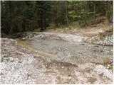 2
2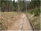 3
3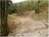 4
4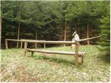 5
5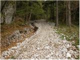 6
6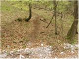 7
7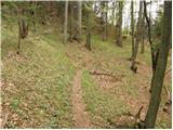 8
8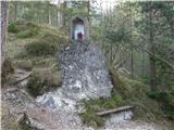 9
9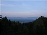 10
10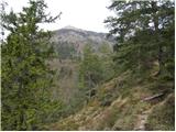 11
11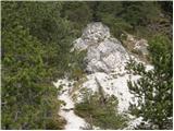 12
12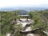 13
13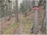 14
14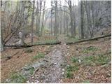 15
15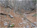 16
16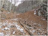 17
17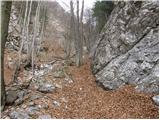 18
18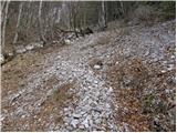 19
19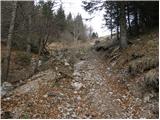 20
20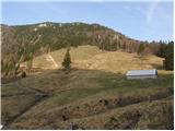 21
21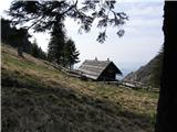 22
22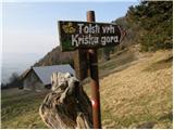 23
23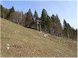 24
24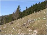 25
25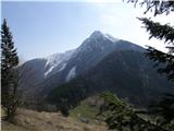 26
26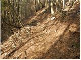 27
27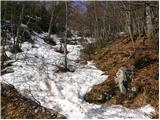 28
28 29
29 30
30 31
31 32
32 33
33 34
34 35
35