Starting point: Zavrate (552 m)
Starting point Lat/Lon: 46.1611°N 15.1522°E 
Time of walking: 2 h 40 min
Difficulty: partly demanding marked way
Difficulty of skiing: no data
Altitude difference: 338 m
Altitude difference (by path): 460 m
Map: Posavsko hribovje - zahodni del 1:50.000
Access to starting point:
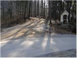
a) We drive into Laško, and then at the traffic light intersection we drive in the direction of Spodnja Rečica. Further on, Laško ends and we arrive at Spodnja Rečica, and later also at Zgornja Rečica, but we continue driving. When the main road turns right towards Šmohor, we go slightly left onto a side road, along which there are signs for Brezno. For a short time, we continue driving through the valley, and then the road turns sharply to the left and crosses onto the northern slopes of Baba, through which we ascend diagonally past individual homesteads. When we return to the forest, we quickly reach the Zavrate saddle, where we park in a suitable place. At the starting point, there is the log cabin Brunarica pri knapu below Baba and one of the entrances to the former Barbara rov mine.
b) From the Hrastnik - Rimske Toplice road, we turn left (or right from the direction of Rimske Toplice) towards the settlements of Sedraž and Trnovo. At the next intersection, we go slightly left towards Brezno, and then we start noticeably ascending towards the Zavrate saddle. When we reach the mentioned saddle, we park in a suitable place.
Path description:
From the Zavrate saddle, we head west on a footpath towards Baba and Ostri vrh (east of the saddle, a path leads to Govško brdo). The path at first leads past a log cabin "Pri knapu pod Babo", and then continues on at first a gentle cart track. After a few minutes of easy walking, we notice a signpost directing us left onto a well-trodden footpath that begins to ascend more steeply. Higher up, the path becomes so steep that fixed safety gear is available for assistance, though not necessary in dry conditions (in wet or snowy conditions, there is a significant risk of slipping). We then follow this quite steep and well-maintained path to the peak of Baba, from where a beautiful view opens up.
From the top of Baba, we continue along a marked ridge path, which first descends and then begins to ascend along the edge of quite steep slopes, dangerous for slipping in wet conditions. The path which occasionally relatively steeply ascends after approximately 40 minutes of walking from Baba brings us on Ostri vrh.
From Ostri vrh, we first descend steeply on a steep slope, where extra caution is needed, especially in wet conditions; after about five minutes of descent, we leave the steep slope, and an unmarked but fairly well-trodden path from the left joins us, leading through the settlement of Krištandol.
We continue straight, first ascending gently, then moderately descending, following the blazes at a few crossings. When we leave the forest, the path first leads past an abandoned farm; below the next house, we reach a macadam road, which we follow to a marked crossing by the NOB monument on Mali Kal.
Here, we continue right towards Kal and Mrzlica (straight to Hrastnik via Blate, left to Dol pri Hrastniku, Kopitnik, and Gore), and on the asphalt road, we first descend gently, then begin ascending again after the chapel. At a nearby house, there is an inscription box for the NOB path. We continue along the road, which first turns right, then follows a long, scenic left turn. We proceed along the marked road, which has several crossroads, and after a stretch of forest, we arrive at the ski slope Rajska dolina. We cross the ski slope (while the ski slope is operating, passage is forbidden and dangerous; passage through the tunnel is also dangerous), and after the next NOB memorial, we reach a marked crossing.
We continue left in the direction of Hrastnik over Klobuk (straight to Hrastnik over Ravne, slightly right to Kal and Mrzlica) on a path that ascends for some time alongside the ski track, then turns right into the forest, where it mostly ascends diagonally. The path higher for a short time flattens, and then it ascends steeper and after few minutes of additional walking brings us on a peak with a beautiful view.
Zavrate - Baba 0:40, Baba - Ostri vrh 0:40, Ostri vrh - Mali Kal 0:20, Mali Kal - Klobuk 1:00.
Pictures:
 1
1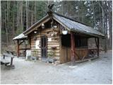 2
2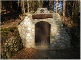 3
3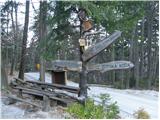 4
4 5
5 6
6 7
7 8
8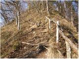 9
9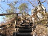 10
10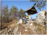 11
11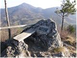 12
12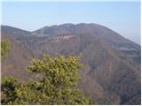 13
13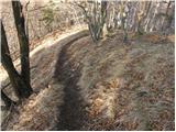 14
14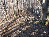 15
15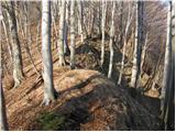 16
16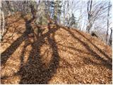 17
17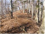 18
18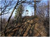 19
19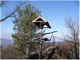 20
20 21
21 22
22 23
23 24
24 25
25 26
26 27
27 28
28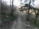 29
29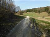 30
30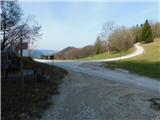 31
31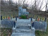 32
32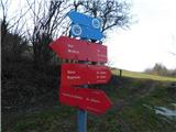 33
33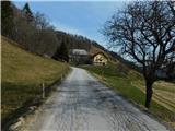 34
34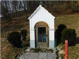 35
35 36
36 37
37 38
38 39
39 40
40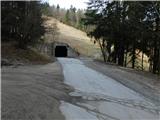 41
41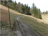 42
42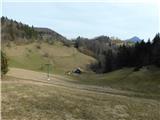 43
43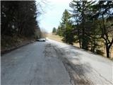 44
44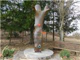 45
45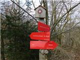 46
46 47
47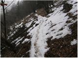 48
48 49
49 50
50 51
51