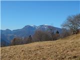
Železniki - Sveti Križ above Selca (via Štalca)
Starting point: Železniki (450 m)
Starting point Lat/Lon: 46.2259°N 14.1693°E 
Path name: via Štalca
Time of walking: 1 h 15 min
Difficulty: easy unmarked way
Difficulty of skiing: no data
Altitude difference: 410 m
Altitude difference (by path): 440 m
Map: Škofjeloško in Cerkljansko hribovje 1:50.000
Access to starting point:
We drive to Železniki, where at the crossroad for Kropa, Dražgoše and Rudno we park on the settled parking lot.
Path description:
From the starting point, we continue on a sidewalk and we walk in the direction of Škofja Loka, and immediately after crossing the stream Češnjica, we go left on a side road. On the side road we walk few 10 strides, and then we go right between two houses, where there is the beginning of a footpath which ascends above Železniki. At first, we are ascending diagonally with a view on Železniki, and then the path passes into the forest and turns more to the right. Further follow numerous crossings, and we continue straight or slightly right, and we also have to be careful, because on certain paths, leads a route of a downhill cycling path. Higher, we stick to the path which lead towards the ridge and then on the ridge we reach the peak of Štalca (642 meters), from which follows some descent. When the path stops descending from the left also joins the path which bypasses the peak of Štalca, and we follow the footpath which continues on or by the ridge. Higher, we step out of the forest, and through a meadow we ascend on a well visible cart track which before the settlement Kališe changes into a macadam road.
We ascend on the road to a crossroad, where the road sign for Dražgoše pointing left, and we continue right upwards and further we are ascending diagonally towards the right (the path which leads from the settlement straight upwards leads through private land and it isn't passable). The settlement soon ends, and the road becomes a macadam and when it passes into the forest from the right joins also the path from the settlement Selca.
Here we go twice left and then right on a beaten footpath which starts ascending steeply. After few minutes of a steep ascent, we step out of the forest, where the path flattens, and to the church of the Holy Cross, which we already see in front of us, separates us only a good minute of walking.
Description and pictures refer to a condition in February 2020.
On the way: Štalca (642m)
Pictures:
 1
1 2
2 3
3 4
4 5
5 6
6 7
7 8
8 9
9 10
10 11
11 12
12 13
13 14
14 15
15 16
16 17
17 18
18 19
19 20
20 21
21 22
22 23
23 24
24 25
25 26
26 27
27 28
28 29
29 30
30 31
31 32
32 33
33