Weather forecast - Gamsleitenspitze
Weather forecast Gamsleitenspitze:
|
| | 2h |
| |  |
| Temperature: | 2 °C |
| Precipitation (mm/h): | 0,03 |
| Cloud Cover: | 99% |
|
| 5h |
 |
| 2 °C |
| 0,25 |
| 94% |
|
| 8h |
 |
| 1 °C |
| 0 |
| 100% |
|
| 11h |
 |
| 3 °C |
| 0 |
| 100% |
|
| 14h |
 |
| 4 °C |
| 0,3 |
| 80% |
|
| 17h |
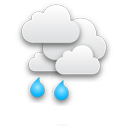 |
| 4 °C |
| 1,5 |
| 80% |
|
| 20h |
 |
| 3 °C |
| 0,83 |
| 94% |
|
| 23h |
 |
| 5 °C |
| 0,42 |
| 99% |
|
|
| | 2h |
| |  |
| Temperature: | 3 °C |
| Precipitation (mm/h): | 0 |
| Cloud Cover: | 95% |
|
| 5h |
 |
| 1 °C |
| 0,08 |
| 99% |
|
| 8h |
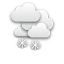 |
| 0 °C |
| 1,5 |
| 100% |
|
| 11h |
 |
| 0 °C |
| 0,3 |
| 100% |
|
| 14h |
 |
| 0 °C |
| 1,5 |
| 100% |
|
| 17h |
 |
| 0 °C |
| 1,5 |
| 100% |
|
| 20h |
 |
| 0 °C |
| 0,57 |
| 99% |
|
| 23h |
 |
| 0 °C |
| 1,16 |
| 99% |
|
|
| | 2h |
| |  |
| Temperature: | 0 °C |
| Precipitation (mm/h): | 1,3 |
| Cloud Cover: | 99% |
|
| 5h |
 |
| 0 °C |
| 0,79 |
| 99% |
|
| 8h |
 |
| -3 °C |
| 1,5 |
| 100% |
|
| 11h |
 |
| -3 °C |
| 1,5 |
| 100% |
|
| 14h |
 |
| -2 °C |
| 0,3 |
| 100% |
|
| 17h |
 |
| -2 °C |
| 1,5 |
| 100% |
|
| 20h |
 |
| 0 °C |
| 0,24 |
| 99% |
|
| 23h |
 |
| 0 °C |
| 0,07 |
| 90% |
|
|
| | 2h |
| |  |
| Temperature: | 0 °C |
| Precipitation (mm/h): | 0,03 |
| Cloud Cover: | 97% |
|
| 5h |
 |
| 0 °C |
| 0 |
| 93% |
|
| 8h |
 |
| 1 °C |
| 0,03 |
| 98% |
|
| 11h |
 |
| 2 °C |
| 0,16 |
| 99% |
|
| 14h |
 |
| 2 °C |
| 0,22 |
| 99% |
|
| 17h |
 |
| 1 °C |
| 0,15 |
| 98% |
|
| 20h |
 |
| 0 °C |
| 0,1 |
| 96% |
|
| 23h |
 |
| 0 °C |
| 0,1 |
| 95% |
|
|
| | 2h |
| |  |
| Temperature: | 0 °C |
| Precipitation (mm/h): | 0 |
| Cloud Cover: | 91% |
|
| 5h |
 |
| 0 °C |
| 0 |
| 88% |
|
| 8h |
 |
| 1 °C |
| 0,03 |
| 92% |
|
| 11h |
 |
| 2 °C |
| 0,03 |
| 97% |
|
| 14h |
 |
| 3 °C |
| 0 |
| 94% |
|
| 17h |
 |
| 2 °C |
| 0 |
| 82% |
|
| 20h |
 |
| 0 °C |
| 0 |
| 79% |
|
| 23h |
 |
| 0 °C |
| 0 |
| 83% |
|
Weather forecast for location Gamsleitenspitze. Gamsleitenspitze is a mountain in Lower Tauern (
Austria) at an altitude of 2359 meters above sea level.
Webcams in radius of
km:
Fageralm,
Fanningberg,
Fanningberg,
Fanningberg (FlyingCam),
Forstau (Bergstation Vorderfager),
Gamskogelhütte,
Gamsleiten,
Gasselhöh Hütte,
Großeck Sender (Mauterndorf),
Grünwaldkopf (Obertauern),
Hochalmkopf (Obertaueren),
Hundsfeldsee - Obertauern,
Kemahdhöhe (Radstadt-Altenmarkt),
Obertauern (Plattenkar),
Obertauern (Zehnerkar),
Radstadt (FlyingCam),
Radstadt (Kemahdhöhe),
Reiteralm,
Reiteralm (Gasselhöh Hütte),
Schladming (Pichl - Reiteralm),
Seekar (Hundeskogel),
Seekarspitz,
Seekarspitze,
Zauchensee,
Zauchensee (FlyingCam)
Mountains in radius of
km:
Panoramas in radius of
km:
Weather forecast on your website (Weather widget)