 Poll: view from Porezen Poll: view from PorezenThe question in the previous poll was: Can Triglav (2864 m) be seen from Porezen (1630 m)? The corr...
|
|
|
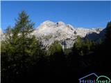
 Skrlatica SkrlaticaYesterday from Vrata. Start at 5h, at the top at 9h....  Golek--769m Golek--769mSnippets from the trip Ljubnica - Golek - Ljubnica. The upper path is normally passable, but at the ...
|
|
|
|
|
|
|
Markacists - CeljeIf you like hiking in the hills and high mountains, and at the same time would like to do something ...
|
|
|
|
|
|
|
|
|
|
|
|
|
|
|
Random trip
 Handalm HandalmHandalm is a 1853-meter-high peak located north to northeast of the alpine pass Weinebene. From the grassy summit, which features small granite rock formations in its center, there is a fine view of the nearby Große Speikkogel, the somewhat distant Velika Svinja / Ladinger Spitze, the highest peak o...
|
|
|
|
|
|
|